Saint-Civran | |
|---|---|
_%C3%89glise_Saint-Cyprien_01.JPG.webp) The church of Saint-Cyprien, in Saint-Civran | |
Location of Saint-Civran | |
 Saint-Civran 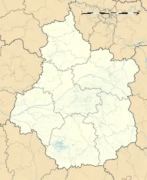 Saint-Civran | |
| Coordinates: 46°29′51″N 1°23′26″E / 46.4975°N 1.3906°E | |
| Country | France |
| Region | Centre-Val de Loire |
| Department | Indre |
| Arrondissement | Le Blanc |
| Canton | Saint-Gaultier |
| Intercommunality | Brenne Val de Creuse |
| Government | |
| • Mayor (2020–2026) | Philippe Guérin[1] |
| Area 1 | 11.61 km2 (4.48 sq mi) |
| Population | 136 |
| • Density | 12/km2 (30/sq mi) |
| Time zone | UTC+01:00 (CET) |
| • Summer (DST) | UTC+02:00 (CEST) |
| INSEE/Postal code | 36187 /36170 |
| Elevation | 133–241 m (436–791 ft) (avg. 220 m or 720 ft) |
| 1 French Land Register data, which excludes lakes, ponds, glaciers > 1 km2 (0.386 sq mi or 247 acres) and river estuaries. | |
Saint-Civran (French pronunciation: [sɛ̃ sivʁɑ̃]; Occitan: Sent Cibran; ultimately from Saint Cyprian) is a commune in the Indre department in central France.
Geography
The river Abloux flows west through the northern part of the commune.
Population
| Year | Pop. | ±% p.a. |
|---|---|---|
| 1968 | 275 | — |
| 1975 | 229 | −2.58% |
| 1982 | 193 | −2.41% |
| 1990 | 158 | −2.47% |
| 1999 | 154 | −0.28% |
| 2009 | 179 | +1.52% |
| 2014 | 166 | −1.50% |
| 2020 | 134 | −3.51% |
| Source: INSEE[3] | ||
See also
References
- ↑ "Répertoire national des élus: les maires". data.gouv.fr, Plateforme ouverte des données publiques françaises (in French). 2 December 2020.
- ↑ "Populations légales 2021". The National Institute of Statistics and Economic Studies. 28 December 2023.
- ↑ Population en historique depuis 1968, INSEE
Wikimedia Commons has media related to Saint-Civran.
This article is issued from Wikipedia. The text is licensed under Creative Commons - Attribution - Sharealike. Additional terms may apply for the media files.