Pirajoux | |
|---|---|
Commune | |
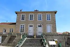 Town hall | |
Location of Pirajoux | |
 Pirajoux  Pirajoux | |
| Coordinates: 46°22′17″N 5°17′58″E / 46.3714°N 5.2994°E | |
| Country | France |
| Region | Auvergne-Rhône-Alpes |
| Department | Ain |
| Arrondissement | Bourg-en-Bresse |
| Canton | Saint-Étienne-du-Bois |
| Intercommunality | CA Bassin de Bourg-en-Bresse |
| Government | |
| • Mayor (2020–2026) | Noël Piroux[1] |
| Area 1 | 12.99 km2 (5.02 sq mi) |
| Population | 407 |
| • Density | 31/km2 (81/sq mi) |
| Time zone | UTC+01:00 (CET) |
| • Summer (DST) | UTC+02:00 (CEST) |
| INSEE/Postal code | 01296 /01270 |
| Elevation | 192–237 m (630–778 ft) (avg. 228 m or 748 ft) |
| 1 French Land Register data, which excludes lakes, ponds, glaciers > 1 km2 (0.386 sq mi or 247 acres) and river estuaries. | |
Pirajoux (French pronunciation: [piʁaʒu]) is a commune in the Ain department in eastern France.
Geography
The Solnan forms most of the commune's eastern border. The Sevron forms parts of the commune's western border.
Population
| Year | Pop. | ±% p.a. |
|---|---|---|
| 1968 | 375 | — |
| 1975 | 314 | −2.50% |
| 1982 | 294 | −0.94% |
| 1990 | 304 | +0.42% |
| 1999 | 299 | −0.18% |
| 2009 | 345 | +1.44% |
| 2014 | 396 | +2.80% |
| 2020 | 413 | +0.70% |
| Source: INSEE[3] | ||
See also
References
- ↑ "Répertoire national des élus: les maires". data.gouv.fr, Plateforme ouverte des données publiques françaises (in French). 2 December 2020.
- ↑ "Populations légales 2021". The National Institute of Statistics and Economic Studies. 28 December 2023.
- ↑ Population en historique depuis 1968, INSEE
Wikimedia Commons has media related to Pirajoux.
This article is issued from Wikipedia. The text is licensed under Creative Commons - Attribution - Sharealike. Additional terms may apply for the media files.