Izenave | |
|---|---|
Commune | |
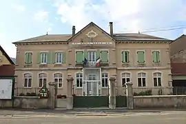 Town hall | |
.svg.png.webp) Coat of arms | |
Location of Izenave | |
 Izenave  Izenave | |
| Coordinates: 46°02′20″N 5°31′33″E / 46.0389°N 5.5258°E | |
| Country | France |
| Region | Auvergne-Rhône-Alpes |
| Department | Ain |
| Arrondissement | Nantua |
| Canton | Plateau d'Hauteville |
| Intercommunality | Haut-Bugey Agglomération |
| Government | |
| • Mayor (2020–2026) | Thiery Druet[1] |
| Area 1 | 13.04 km2 (5.03 sq mi) |
| Population | 155 |
| • Density | 12/km2 (31/sq mi) |
| Time zone | UTC+01:00 (CET) |
| • Summer (DST) | UTC+02:00 (CEST) |
| INSEE/Postal code | 01191 /01430 |
| Elevation | 663–1,008 m (2,175–3,307 ft) (avg. 690 m or 2,260 ft) |
| 1 French Land Register data, which excludes lakes, ponds, glaciers > 1 km2 (0.386 sq mi or 247 acres) and river estuaries. | |
Izenave (French pronunciation: [iznav] ⓘ) is a commune in the Ain department in eastern France.
Population
| Year | Pop. | ±% p.a. |
|---|---|---|
| 1968 | 169 | — |
| 1975 | 138 | −2.85% |
| 1982 | 117 | −2.33% |
| 1990 | 130 | +1.33% |
| 1999 | 146 | +1.30% |
| 2009 | 161 | +0.98% |
| 2014 | 173 | +1.45% |
| 2020 | 152 | −2.13% |
| Source: INSEE[3] | ||
See also
References
- ↑ "Répertoire national des élus: les maires". data.gouv.fr, Plateforme ouverte des données publiques françaises (in French). 2 December 2020.
- ↑ "Populations légales 2021". The National Institute of Statistics and Economic Studies. 28 December 2023.
- ↑ Population en historique depuis 1968, INSEE
Wikimedia Commons has media related to Izenave.
This article is issued from Wikipedia. The text is licensed under Creative Commons - Attribution - Sharealike. Additional terms may apply for the media files.