Gorrevod | |
|---|---|
Commune | |
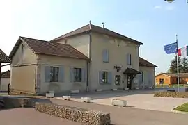 Town hall | |
.svg.png.webp) Coat of arms | |
Location of Gorrevod | |
 Gorrevod  Gorrevod | |
| Coordinates: 46°25′00″N 4°56′31″E / 46.4167°N 4.9419°E | |
| Country | France |
| Region | Auvergne-Rhône-Alpes |
| Department | Ain |
| Arrondissement | Bourg-en-Bresse |
| Canton | Replonges |
| Government | |
| • Mayor (2020–2026) | Henri Guillermin[1] |
| Area 1 | 6.88 km2 (2.66 sq mi) |
| Population | 786 |
| • Density | 110/km2 (300/sq mi) |
| Time zone | UTC+01:00 (CET) |
| • Summer (DST) | UTC+02:00 (CEST) |
| INSEE/Postal code | 01175 /01190 |
| Elevation | 172–204 m (564–669 ft) (avg. 236 m or 774 ft) |
| 1 French Land Register data, which excludes lakes, ponds, glaciers > 1 km2 (0.386 sq mi or 247 acres) and river estuaries. | |
Gorrevod (French pronunciation: [ɡɔʁvo]; Arpitan: Gorrevôd) is a commune in the Ain department in eastern France.
Population
| Year | Pop. | ±% p.a. |
|---|---|---|
| 1968 | 356 | — |
| 1975 | 400 | +1.68% |
| 1982 | 441 | +1.40% |
| 1990 | 512 | +1.88% |
| 1999 | 561 | +1.02% |
| 2009 | 781 | +3.36% |
| 2014 | 842 | +1.52% |
| 2020 | 790 | −1.06% |
| Source: INSEE[3] | ||
See also
References
- ↑ "Répertoire national des élus: les maires". data.gouv.fr, Plateforme ouverte des données publiques françaises (in French). 2 December 2020.
- ↑ "Populations légales 2021". The National Institute of Statistics and Economic Studies. 28 December 2023.
- ↑ Population en historique depuis 1968, INSEE
Wikimedia Commons has media related to Gorrevod.
This article is issued from Wikipedia. The text is licensed under Creative Commons - Attribution - Sharealike. Additional terms may apply for the media files.