| Russvatnet | |
|---|---|
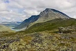 View of the lake with Besshø to the right | |
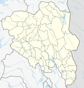 Russvatnet Location of the lake Show map of Innlandet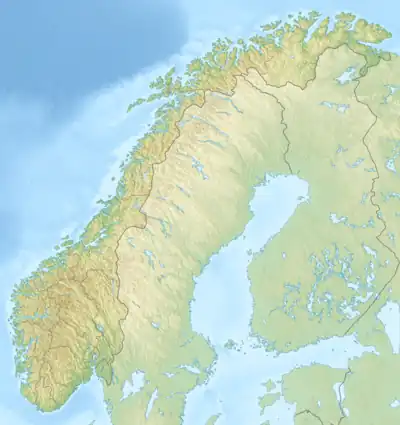 Russvatnet Russvatnet (Norway) Show map of Norway | |
| Location | Vågå Municipality, Innlandet |
| Coordinates | 61°33′1.7″N 8°40′33.3″E / 61.550472°N 8.675917°E / 61.550472; 8.675917 |
| Primary outflows | River Russa |
| Catchment area | Sjoa |
| Basin countries | Norway |
| Max. length | 10.3 kilometres (6.4 mi) |
| Max. width | 500 metres (1,600 ft) |
| Surface area | 4.6221 km2 (1.7846 sq mi) |
| Shore length1 | 22.93 kilometres (14.25 mi) |
| Surface elevation | 1,175 metres (3,855 ft) |
| References | NVE[1] |
| 1 Shore length is not a well-defined measure. | |
Russvatnet is a lake in Vågå Municipality in Innlandet county, Norway. The 4.6-square-kilometre (1.8 sq mi) lake is located in the Jotunheimen mountain range and also within Jotunheimen National Park. It lies in a U-shaped valley between the mountains Surtningssue, Nautgardstinden, and Besshø.
See also
References
- ↑ "Innsjødatabase". nve.no (in Norwegian). Retrieved 29 May 2022.
This article is issued from Wikipedia. The text is licensed under Creative Commons - Attribution - Sharealike. Additional terms may apply for the media files.