Quérénaing | |
|---|---|
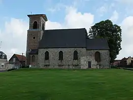 The church in Quérénaing | |
.svg.png.webp) Coat of arms | |
Location of Quérénaing | |
 Quérénaing  Quérénaing | |
| Coordinates: 50°17′16″N 3°30′52″E / 50.2878°N 3.5144°E | |
| Country | France |
| Region | Hauts-de-France |
| Department | Nord |
| Arrondissement | Valenciennes |
| Canton | Aulnoy-lez-Valenciennes |
| Intercommunality | CA Valenciennes Métropole |
| Government | |
| • Mayor (2020–2026) | Didier Joveniaux[1] |
| Area 1 | 4.32 km2 (1.67 sq mi) |
| Population | 861 |
| • Density | 200/km2 (520/sq mi) |
| Time zone | UTC+01:00 (CET) |
| • Summer (DST) | UTC+02:00 (CEST) |
| INSEE/Postal code | 59480 /59269 |
| Elevation | 71–102 m (233–335 ft) (avg. 87 m or 285 ft) |
| 1 French Land Register data, which excludes lakes, ponds, glaciers > 1 km2 (0.386 sq mi or 247 acres) and river estuaries. | |
Quérénaing (French pronunciation: [keʁenɛ̃]) is a commune in the Nord department in northern France.[3]
Heraldry
Arms of Quérénaing |
The arms of Quérénaing are blazoned : Or, a cross engrailed gules. (Artres, Bettrechies, Cerfontaine, Denain, Eth, Lesquin, Obies, Quérénaing, Semousies, Wambrechies and Warlaing use the same arms.)
|
See also
References
- ↑ "Répertoire national des élus: les maires". data.gouv.fr, Plateforme ouverte des données publiques françaises (in French). 2 December 2020.
- ↑ "Populations légales 2021". The National Institute of Statistics and Economic Studies. 28 December 2023.
- ↑ INSEE commune file
Wikimedia Commons has media related to Quérénaing.
This article is issued from Wikipedia. The text is licensed under Creative Commons - Attribution - Sharealike. Additional terms may apply for the media files.