Ghissignies | |
|---|---|
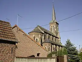 The church in Ghissignies | |
.svg.png.webp) Coat of arms | |
Location of Ghissignies | |
 Ghissignies  Ghissignies | |
| Coordinates: 50°13′38″N 3°37′04″E / 50.2272°N 3.6178°E | |
| Country | France |
| Region | Hauts-de-France |
| Department | Nord |
| Arrondissement | Avesnes-sur-Helpe |
| Canton | Avesnes-sur-Helpe |
| Intercommunality | Pays de Mormal |
| Government | |
| • Mayor (2020–2026) | Pierre Deudon[1] |
| Area 1 | 4.52 km2 (1.75 sq mi) |
| Population | 498 |
| • Density | 110/km2 (290/sq mi) |
| Time zone | UTC+01:00 (CET) |
| • Summer (DST) | UTC+02:00 (CEST) |
| INSEE/Postal code | 59259 /59530 |
| Elevation | 82–134 m (269–440 ft) (avg. 116 m or 381 ft) |
| 1 French Land Register data, which excludes lakes, ponds, glaciers > 1 km2 (0.386 sq mi or 247 acres) and river estuaries. | |
Ghissignies (French pronunciation: [ɡisiɲi]) is a commune in the Nord department in northern France.[3]
Heraldry
Arms of Ghissignies |
The arms of Ghissignies are blazoned : Azure, semy de lys Or dimidiated with Vert, a fess argent. (Ghissignies and Haspres use the same arms.)
|
See also
References
- ↑ "Répertoire national des élus: les maires". data.gouv.fr, Plateforme ouverte des données publiques françaises (in French). 2 December 2020.
- ↑ "Populations légales 2021". The National Institute of Statistics and Economic Studies. 28 December 2023.
- ↑ INSEE commune file
Wikimedia Commons has media related to Ghissignies.
This article is issued from Wikipedia. The text is licensed under Creative Commons - Attribution - Sharealike. Additional terms may apply for the media files.