Noordpeene | |
|---|---|
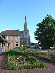 The church in Noordpeene | |
_Nord-France.svg.png.webp) Coat of arms | |
Location of Noordpeene | |
 Noordpeene  Noordpeene | |
| Coordinates: 50°48′23″N 2°23′53″E / 50.8064°N 2.3981°E | |
| Country | France |
| Region | Hauts-de-France |
| Department | Nord |
| Arrondissement | Dunkerque |
| Canton | Wormhout |
| Intercommunality | CC Flandre Intérieure |
| Government | |
| • Mayor (2020–2026) | Thierry Dehondt-Bedague[1] |
| Area 1 | 17.12 km2 (6.61 sq mi) |
| Population | 800 |
| • Density | 47/km2 (120/sq mi) |
| Demonym | Noordpéenois·e |
| Time zone | UTC+01:00 (CET) |
| • Summer (DST) | UTC+02:00 (CEST) |
| INSEE/Postal code | 59436 /59670 |
| Elevation | 0–68 m (0–223 ft) (avg. 27 m or 89 ft) |
| 1 French Land Register data, which excludes lakes, ponds, glaciers > 1 km2 (0.386 sq mi or 247 acres) and river estuaries. | |
Noordpeene (Dutch: Noordpene, West Flemish: Nôordpene) is a commune in the Nord department, Hauts-de-France, France.[3]
The small river Peene Becque flows through the village.
Heraldry
Arms of Noordpeene |
The arms of Noordpeene are blazoned : Argent, 5 fusils conjoined in bend gules. (probably not heraldically different from West-Cappel)
|
See also
References
- ↑ "Répertoire national des élus: les maires". data.gouv.fr, Plateforme ouverte des données publiques françaises (in French). 9 August 2021.
- ↑ "Populations légales 2021". The National Institute of Statistics and Economic Studies. 28 December 2023.
- ↑ INSEE commune file
External links
Wikimedia Commons has media related to Noordpeene.
This article is issued from Wikipedia. The text is licensed under Creative Commons - Attribution - Sharealike. Additional terms may apply for the media files.