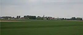
Hondeghem
Hondegem | |
|---|---|
 Hondeghem in the arrondissement of Dunkirk | |
_Nord-France.svg.png.webp) Coat of arms | |
Location of Hondeghem | |
 Hondeghem  Hondeghem | |
| Coordinates: 50°45′27″N 2°31′19″E / 50.7575°N 2.5219°E | |
| Country | France |
| Region | Hauts-de-France |
| Department | Nord |
| Arrondissement | Dunkirk |
| Canton | Bailleul |
| Intercommunality | Flandre Intérieure |
| Government | |
| • Mayor (2020–2026) | Jean-Pierre Feramus[1] |
| Area 1 | 12.6 km2 (4.9 sq mi) |
| Population | 913 |
| • Density | 72/km2 (190/sq mi) |
| Time zone | UTC+01:00 (CET) |
| • Summer (DST) | UTC+02:00 (CEST) |
| INSEE/Postal code | 59308 /59190 |
| Elevation | 24–57 m (79–187 ft) (avg. 41 m or 135 ft) |
| 1 French Land Register data, which excludes lakes, ponds, glaciers > 1 km2 (0.386 sq mi or 247 acres) and river estuaries. | |
Hondeghem (French pronunciation: [ɔ̃dɡɛm]; from Flemish; Hondegem in modern Dutch spelling) is a commune in the Nord department in northern France.[3]
Heraldry
Arms of Hondeghem |
The arms of Hondeghem are blazoned : Argent, a fess embattled counterembattled gules.
|
See also
References
- ↑ "Répertoire national des élus: les maires". data.gouv.fr, Plateforme ouverte des données publiques françaises (in French). 2 December 2020.
- ↑ "Populations légales 2021". The National Institute of Statistics and Economic Studies. 28 December 2023.
- ↑ INSEE commune file
Wikimedia Commons has media related to Hondeghem.
This article is issued from Wikipedia. The text is licensed under Creative Commons - Attribution - Sharealike. Additional terms may apply for the media files.