Valfleury | |
|---|---|
Commune | |
 | |
Location of Valfleury | |
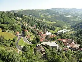
 Valfleury  Valfleury | |
| Coordinates: 45°31′23″N 4°29′36″E / 45.5231°N 4.4933°E | |
| Country | France |
| Region | Auvergne-Rhône-Alpes |
| Department | Loire |
| Arrondissement | Saint-Étienne |
| Canton | Sorbiers |
| Intercommunality | Saint-Étienne Métropole |
| Government | |
| • Mayor (2020–2026) | Denis Laurent[1] |
| Area 1 | 8.77 km2 (3.39 sq mi) |
| Population | 709 |
| • Density | 81/km2 (210/sq mi) |
| Time zone | UTC+01:00 (CET) |
| • Summer (DST) | UTC+02:00 (CEST) |
| INSEE/Postal code | 42320 /42320 |
| Elevation | 359–820 m (1,178–2,690 ft) (avg. 720 m or 2,360 ft) |
| 1 French Land Register data, which excludes lakes, ponds, glaciers > 1 km2 (0.386 sq mi or 247 acres) and river estuaries. | |
Valfleury (French pronunciation: [valflœʁi]) is a commune in the Loire department in central France.
Population
| Year | Pop. | ±% p.a. |
|---|---|---|
| 1968 | 367 | — |
| 1975 | 370 | +0.12% |
| 1982 | 437 | +2.41% |
| 1990 | 486 | +1.34% |
| 1999 | 516 | +0.67% |
| 2009 | 645 | +2.26% |
| 2014 | 704 | +1.77% |
| 2020 | 707 | +0.07% |
| Source: INSEE[3] | ||
See also
References
- ↑ "Répertoire national des élus: les maires". data.gouv.fr, Plateforme ouverte des données publiques françaises (in French). 9 August 2021.
- ↑ "Populations légales 2021". The National Institute of Statistics and Economic Studies. 28 December 2023.
- ↑ Population en historique depuis 1968, INSEE
Wikimedia Commons has media related to Valfleury.
This article is issued from Wikipedia. The text is licensed under Creative Commons - Attribution - Sharealike. Additional terms may apply for the media files.