Montverdun | |
|---|---|
Commune | |
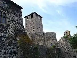 Church and ramparts | |
.svg.png.webp) Coat of arms | |
Location of Montverdun | |
 Montverdun  Montverdun | |
| Coordinates: 45°42′56″N 4°04′04″E / 45.7156°N 4.0678°E | |
| Country | France |
| Region | Auvergne-Rhône-Alpes |
| Department | Loire |
| Arrondissement | Montbrison |
| Canton | Boën-sur-Lignon |
| Intercommunality | CA Loire Forez |
| Government | |
| • Mayor (2020–2026) | Martine Matrat[1] |
| Area 1 | 16.52 km2 (6.38 sq mi) |
| Population | 1,322 |
| • Density | 80/km2 (210/sq mi) |
| Time zone | UTC+01:00 (CET) |
| • Summer (DST) | UTC+02:00 (CEST) |
| INSEE/Postal code | 42150 /42130 |
| Elevation | 340–531 m (1,115–1,742 ft) (avg. 378 m or 1,240 ft) |
| 1 French Land Register data, which excludes lakes, ponds, glaciers > 1 km2 (0.386 sq mi or 247 acres) and river estuaries. | |
Montverdun (French pronunciation: [mɔ̃vɛʁdœ̃]) is a commune in the Loire department in central France.
Geography
The river Lignon du Forez flows through the commune.
Population
| Year | Pop. | ±% p.a. |
|---|---|---|
| 1968 | 605 | — |
| 1975 | 605 | +0.00% |
| 1982 | 613 | +0.19% |
| 1990 | 698 | +1.64% |
| 1999 | 759 | +0.94% |
| 2009 | 1,060 | +3.40% |
| 2014 | 1,254 | +3.42% |
| 2020 | 1,358 | +1.34% |
| Source: INSEE[3] | ||
See also
References
- ↑ "Répertoire national des élus: les maires" (in French). data.gouv.fr, Plateforme ouverte des données publiques françaises. 13 September 2022.
- ↑ "Populations légales 2021". The National Institute of Statistics and Economic Studies. 28 December 2023.
- ↑ Population en historique depuis 1968, INSEE
Wikimedia Commons has media related to Montverdun.
This article is issued from Wikipedia. The text is licensed under Creative Commons - Attribution - Sharealike. Additional terms may apply for the media files.