Domesmont | |
|---|---|
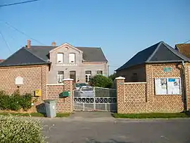 The town hall and school in Domesmont | |
.svg.png.webp) Coat of arms | |
Location of Domesmont | |
 Domesmont  Domesmont | |
| Coordinates: 50°07′19″N 2°08′53″E / 50.122°N 2.1481°E | |
| Country | France |
| Region | Hauts-de-France |
| Department | Somme |
| Arrondissement | Amiens |
| Canton | Doullens |
| Intercommunality | CC Territoire Nord Picardie |
| Government | |
| • Mayor (2020–2026) | Joël Bazin[1] |
| Area 1 | 1.94 km2 (0.75 sq mi) |
| Population | 44 |
| • Density | 23/km2 (59/sq mi) |
| Time zone | UTC+01:00 (CET) |
| • Summer (DST) | UTC+02:00 (CEST) |
| INSEE/Postal code | 80243 /80370 |
| Elevation | 90–150 m (300–490 ft) (avg. 143 m or 469 ft) |
| 1 French Land Register data, which excludes lakes, ponds, glaciers > 1 km2 (0.386 sq mi or 247 acres) and river estuaries. | |
Domesmont (Picard: Domémont ) is a commune in the Somme department in Hauts-de-France in northern France.
Geography
Domesmont is situated on the D188 road, some 20 miles (32 km) east of Abbeville.
Population
| Year | Pop. | ±% p.a. |
|---|---|---|
| 1968 | 71 | — |
| 1975 | 63 | −1.69% |
| 1982 | 60 | −0.69% |
| 1990 | 52 | −1.77% |
| 1999 | 44 | −1.84% |
| 2007 | 40 | −1.18% |
| 2012 | 46 | +2.83% |
| 2017 | 45 | −0.44% |
| Source: INSEE[3] | ||
See also
References
- ↑ "Répertoire national des élus: les maires". data.gouv.fr, Plateforme ouverte des données publiques françaises (in French). 2 December 2020.
- ↑ "Populations légales 2021". The National Institute of Statistics and Economic Studies. 28 December 2023.
- ↑ Population en historique depuis 1968, INSEE
Wikimedia Commons has media related to Domesmont.
This article is issued from Wikipedia. The text is licensed under Creative Commons - Attribution - Sharealike. Additional terms may apply for the media files.