Bresle | |
|---|---|
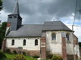 The church in Bresle | |
.svg.png.webp) Coat of arms | |
Location of Bresle | |
 Bresle  Bresle | |
| Coordinates: 49°59′02″N 2°33′29″E / 49.984°N 2.558°E | |
| Country | France |
| Region | Hauts-de-France |
| Department | Somme |
| Arrondissement | Amiens |
| Canton | Corbie |
| Intercommunality | Val de Somme |
| Government | |
| • Mayor (2020–2026) | Jean-Luc Faloise[1] |
| Area 1 | 3.54 km2 (1.37 sq mi) |
| Population | 120 |
| • Density | 34/km2 (88/sq mi) |
| Time zone | UTC+01:00 (CET) |
| • Summer (DST) | UTC+02:00 (CEST) |
| INSEE/Postal code | 80138 /80300 |
| Elevation | 55–123 m (180–404 ft) (avg. 62 m or 203 ft) |
| 1 French Land Register data, which excludes lakes, ponds, glaciers > 1 km2 (0.386 sq mi or 247 acres) and river estuaries. | |
Bresle (French pronunciation: [bʁɛl]; Picard: Brèle) is a commune in the Somme department in Hauts-de-France in northern France.
Geography
Bresle is situated on the D226 road, some 16 miles (26 km) northwest of Amiens.
Population
| Year | Pop. | ±% p.a. |
|---|---|---|
| 1968 | 102 | — |
| 1975 | 92 | −1.46% |
| 1982 | 90 | −0.31% |
| 1990 | 83 | −1.01% |
| 1999 | 74 | −1.27% |
| 2007 | 96 | +3.31% |
| 2012 | 123 | +5.08% |
| 2017 | 128 | +0.80% |
| Source: INSEE[3] | ||
See also
References
- ↑ "Répertoire national des élus: les maires". data.gouv.fr, Plateforme ouverte des données publiques françaises (in French). 2 December 2020.
- ↑ "Populations légales 2021". The National Institute of Statistics and Economic Studies. 28 December 2023.
- ↑ Population en historique depuis 1968, INSEE
External links
Wikimedia Commons has media related to Bresle (Somme).
- Bresle on the Quid website (in French)
This article is issued from Wikipedia. The text is licensed under Creative Commons - Attribution - Sharealike. Additional terms may apply for the media files.