Boismont | |
|---|---|
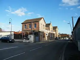 The town hall and school in Boismont | |
 Coat of arms | |
Location of Boismont | |
 Boismont  Boismont | |
| Coordinates: 50°09′12″N 1°41′10″E / 50.1533°N 1.6861°E | |
| Country | France |
| Region | Hauts-de-France |
| Department | Somme |
| Arrondissement | Abbeville |
| Canton | Abbeville-2 |
| Intercommunality | CA Baie de Somme |
| Government | |
| • Mayor (2020–2026) | Daniel Lenne[1] |
| Area 1 | 15.57 km2 (6.01 sq mi) |
| Population | 472 |
| • Density | 30/km2 (79/sq mi) |
| Time zone | UTC+01:00 (CET) |
| • Summer (DST) | UTC+02:00 (CEST) |
| INSEE/Postal code | 80110 /80230 |
| Elevation | 0–46 m (0–151 ft) (avg. 45 m or 148 ft) |
| 1 French Land Register data, which excludes lakes, ponds, glaciers > 1 km2 (0.386 sq mi or 247 acres) and river estuaries. | |
Boismont (French pronunciation: [bwamɔ̃]) is a commune in the Somme department in Hauts-de-France in northern France.
Geography
The commune is situated on the D3 road, some 5 miles (8 km) northwest of Abbeville and close to the estuary of the river Somme.
Population
| Year | Pop. | ±% p.a. |
|---|---|---|
| 1968 | 511 | — |
| 1975 | 509 | −0.06% |
| 1982 | 526 | +0.47% |
| 1990 | 551 | +0.58% |
| 1999 | 497 | −1.14% |
| 2007 | 464 | −0.86% |
| 2012 | 475 | +0.47% |
| 2017 | 475 | +0.00% |
| Source: INSEE[3] | ||
See also
References
- ↑ "Répertoire national des élus: les maires". data.gouv.fr, Plateforme ouverte des données publiques françaises (in French). 2 December 2020.
- ↑ "Populations légales 2021". The National Institute of Statistics and Economic Studies. 28 December 2023.
- ↑ Population en historique depuis 1968, INSEE
Wikimedia Commons has media related to Boismont (Somme).
This article is issued from Wikipedia. The text is licensed under Creative Commons - Attribution - Sharealike. Additional terms may apply for the media files.