Baizieux | |
|---|---|
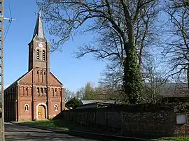 The church of Baizieux | |
.svg.png.webp) Coat of arms | |
Location of Baizieux | |
 Baizieux  Baizieux | |
| Coordinates: 49°59′37″N 2°31′11″E / 49.9936°N 2.5197°E | |
| Country | France |
| Region | Hauts-de-France |
| Department | Somme |
| Arrondissement | Amiens |
| Canton | Corbie |
| Intercommunality | CC du Val de Somme |
| Government | |
| • Mayor (2020–2026) | Marie-Josée Vaquier[1] |
| Area 1 | 5.09 km2 (1.97 sq mi) |
| Population | 232 |
| • Density | 46/km2 (120/sq mi) |
| Time zone | UTC+01:00 (CET) |
| • Summer (DST) | UTC+02:00 (CEST) |
| INSEE/Postal code | 80052 /80300 |
| Elevation | 61–127 m (200–417 ft) (avg. 107 m or 351 ft) |
| 1 French Land Register data, which excludes lakes, ponds, glaciers > 1 km2 (0.386 sq mi or 247 acres) and river estuaries. | |
Baizieux (French pronunciation: [bɛzjø]; Picard: Boaiziu) is a commune in the Somme department in Hauts-de-France in northern France.
Geography
Situated 20 miles (32 km) northeast of Amiens, on the D179 road.
Population
| Year | Pop. | ±% p.a. |
|---|---|---|
| 1968 | 172 | — |
| 1975 | 172 | +0.00% |
| 1982 | 155 | −1.48% |
| 1990 | 183 | +2.10% |
| 1999 | 215 | +1.81% |
| 2007 | 227 | +0.68% |
| 2012 | 203 | −2.21% |
| 2017 | 207 | +0.39% |
| Source: INSEE[3] | ||
See also
References
- ↑ "Répertoire national des élus: les maires". data.gouv.fr, Plateforme ouverte des données publiques françaises (in French). 2 December 2020.
- ↑ "Populations légales 2021". The National Institute of Statistics and Economic Studies. 28 December 2023.
- ↑ Population en historique depuis 1968, INSEE
Wikimedia Commons has media related to Baizieux.
This article is issued from Wikipedia. The text is licensed under Creative Commons - Attribution - Sharealike. Additional terms may apply for the media files.