Bouvelinghem
Bovelingem | |
|---|---|
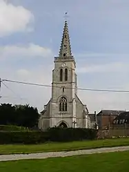 The church of Bouvelinghem | |
 Coat of arms | |
Location of Bouvelinghem | |
 Bouvelinghem  Bouvelinghem | |
| Coordinates: 50°44′03″N 2°01′58″E / 50.7342°N 2.0328°E | |
| Country | France |
| Region | Hauts-de-France |
| Department | Pas-de-Calais |
| Arrondissement | Saint-Omer |
| Canton | Lumbres |
| Intercommunality | Pays de Lumbres |
| Government | |
| • Mayor (2020–2026) | Dominique Sénécat[1] |
| Area 1 | 6.28 km2 (2.42 sq mi) |
| Population | 251 |
| • Density | 40/km2 (100/sq mi) |
| Time zone | UTC+01:00 (CET) |
| • Summer (DST) | UTC+02:00 (CEST) |
| INSEE/Postal code | 62169 /62380 |
| Elevation | 98–196 m (322–643 ft) (avg. 175 m or 574 ft) |
| 1 French Land Register data, which excludes lakes, ponds, glaciers > 1 km2 (0.386 sq mi or 247 acres) and river estuaries. | |
Bouvelinghem (French pronunciation: [buvlɛ̃ɡɑ̃]; Picard: Bouvelinghin; West Flemish: Bovelingem) is a commune in the Pas-de-Calais department in the Hauts-de-France region in northern France.[3]
Geography
A village situated 10 miles (16 km) west of Saint-Omer, on the D208 road. It was completely destroyed by fire in 1876.
Population
| Year | Pop. | ±% |
|---|---|---|
| 1962 | 127 | — |
| 1968 | 155 | +22.0% |
| 1975 | 179 | +15.5% |
| 1982 | 158 | −11.7% |
| 1990 | 162 | +2.5% |
| 1999 | 142 | −12.3% |
| 2009 | 234 | +64.8% |
Sights
- The church of the Assumption, dating from the early 20th century.
- The ruins of a chateau.
See also
References
- ↑ "Répertoire national des élus: les maires". data.gouv.fr, Plateforme ouverte des données publiques françaises (in French). 2 December 2020.
- ↑ "Populations légales 2021". The National Institute of Statistics and Economic Studies. 28 December 2023.
- ↑ INSEE commune file
Wikimedia Commons has media related to Bouvelinghem.
This article is issued from Wikipedia. The text is licensed under Creative Commons - Attribution - Sharealike. Additional terms may apply for the media files.