Aix-en-Ergny | |
|---|---|
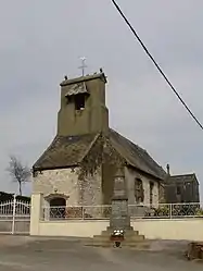 The church of Aix-en-Ergny | |
.svg.png.webp) Coat of arms | |
Location of Aix-en-Ergny | |
 Aix-en-Ergny  Aix-en-Ergny | |
| Coordinates: 50°34′59″N 1°59′53″E / 50.5831°N 1.9981°E / 50.5831; 1.9981 | |
| Country | France |
| Region | Hauts-de-France |
| Department | Pas-de-Calais |
| Arrondissement | Montreuil |
| Canton | Lumbres |
| Intercommunality | Haut Pays du Montreuillois |
| Government | |
| • Mayor (2020–2026) | David Gillet[1] |
| Area 1 | 4.83 km2 (1.86 sq mi) |
| Population | 202 |
| • Density | 42/km2 (110/sq mi) |
| Time zone | UTC+01:00 (CET) |
| • Summer (DST) | UTC+02:00 (CEST) |
| INSEE/Postal code | 62017 /62650 |
| Elevation | 97–167 m (318–548 ft) (avg. 107 m or 351 ft) |
| 1 French Land Register data, which excludes lakes, ponds, glaciers > 1 km2 (0.386 sq mi or 247 acres) and river estuaries. | |
Aix-en-Ergny (French pronunciation: [ɛks ɑ̃n‿ɛʁɲi]) is a commune in the Pas-de-Calais department in northern France.[3]
Geography
A small village situated some 20 miles (32 km) southeast of Boulogne-sur-Mer, on the D148E road.
Population
| Year | Pop. | ±% p.a. |
|---|---|---|
| 1968 | 159 | — |
| 1975 | 147 | −1.11% |
| 1982 | 128 | −1.96% |
| 1990 | 120 | −0.80% |
| 1999 | 104 | −1.58% |
| 2007 | 148 | +4.51% |
| 2012 | 180 | +3.99% |
| 2017 | 189 | +0.98% |
| Source: INSEE[4] | ||
See also
References
- ↑ "Répertoire national des élus: les maires" (in French). data.gouv.fr, Plateforme ouverte des données publiques françaises. 13 September 2022.
- ↑ "Populations légales 2021". The National Institute of Statistics and Economic Studies. 28 December 2023.
- ↑ INSEE commune file
- ↑ Population en historique depuis 1968, INSEE
Wikimedia Commons has media related to Aix-en-Ergny.
This article is issued from Wikipedia. The text is licensed under Creative Commons - Attribution - Sharealike. Additional terms may apply for the media files.