Troësnes | |
|---|---|
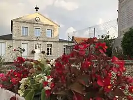 The town hall of Troësnes | |
Location of Troësnes | |
 Troësnes  Troësnes | |
| Coordinates: 49°11′38″N 3°10′14″E / 49.1939°N 3.1706°E | |
| Country | France |
| Region | Hauts-de-France |
| Department | Aisne |
| Arrondissement | Soissons |
| Canton | Villers-Cotterêts |
| Intercommunality | Retz en Valois |
| Government | |
| • Mayor (2020–2026) | Nathalie Gautier[1] |
| Area 1 | 2.75 km2 (1.06 sq mi) |
| Population | 214 |
| • Density | 78/km2 (200/sq mi) |
| Time zone | UTC+01:00 (CET) |
| • Summer (DST) | UTC+02:00 (CEST) |
| INSEE/Postal code | 02749 /02460 |
| Elevation | 66–141 m (217–463 ft) (avg. 70 m or 230 ft) |
| 1 French Land Register data, which excludes lakes, ponds, glaciers > 1 km2 (0.386 sq mi or 247 acres) and river estuaries. | |
Troësnes (French pronunciation: [tʁɔɛn]) is a commune in the Aisne department in Hauts-de-France in northern France.[3]
Population
| Year | Pop. | ±% |
|---|---|---|
| 1962 | 169 | — |
| 1968 | 125 | −26.0% |
| 1975 | 113 | −9.6% |
| 1982 | 117 | +3.5% |
| 1990 | 188 | +60.7% |
| 1999 | 213 | +13.3% |
| 2008 | 229 | +7.5% |
See also
References
- ↑ "Répertoire national des élus: les maires". data.gouv.fr, Plateforme ouverte des données publiques françaises (in French). 9 August 2021.
- ↑ "Populations légales 2021". The National Institute of Statistics and Economic Studies. 28 December 2023.
- ↑ Commune de Troësnes (02749), INSEE
Wikimedia Commons has media related to Troësnes.
This article is issued from Wikipedia. The text is licensed under Creative Commons - Attribution - Sharealike. Additional terms may apply for the media files.