Martigny-Courpierre | |
|---|---|
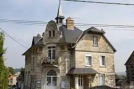 The town hall of Martigny-Courpierre | |
Location of Martigny-Courpierre | |
 Martigny-Courpierre  Martigny-Courpierre | |
| Coordinates: 49°29′27″N 3°40′51″E / 49.4908°N 3.6808°E | |
| Country | France |
| Region | Hauts-de-France |
| Department | Aisne |
| Arrondissement | Laon |
| Canton | Laon-2 |
| Intercommunality | CA Pays de Laon |
| Government | |
| • Mayor (2020–2026) | Christian Lambert[1] |
| Area 1 | 4.46 km2 (1.72 sq mi) |
| Population | 134 |
| • Density | 30/km2 (78/sq mi) |
| Time zone | UTC+01:00 (CET) |
| • Summer (DST) | UTC+02:00 (CEST) |
| INSEE/Postal code | 02471 /02860 |
| Elevation | 78–196 m (256–643 ft) (avg. 80 m or 260 ft) |
| 1 French Land Register data, which excludes lakes, ponds, glaciers > 1 km2 (0.386 sq mi or 247 acres) and river estuaries. | |
Martigny-Courpierre (French pronunciation: [maʁtiɲi kuʁpjɛʁ]) is a commune in the Aisne department in Hauts-de-France in northern France.
Population
| Year | Pop. | ±% |
|---|---|---|
| 1962 | 121 | — |
| 1968 | 115 | −5.0% |
| 1975 | 105 | −8.7% |
| 1982 | 91 | −13.3% |
| 1990 | 103 | +13.2% |
| 1999 | 122 | +18.4% |
| 2008 | 114 | −6.6% |
See also
References
- ↑ "Répertoire national des élus: les maires". data.gouv.fr, Plateforme ouverte des données publiques françaises (in French). 2 December 2020.
- ↑ "Populations légales 2021". The National Institute of Statistics and Economic Studies. 28 December 2023.
Wikimedia Commons has media related to Martigny-Courpierre.
This article is issued from Wikipedia. The text is licensed under Creative Commons - Attribution - Sharealike. Additional terms may apply for the media files.