Tramolé | |
|---|---|
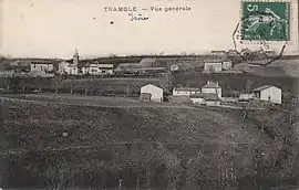 Tramolé in 1915 | |
Location of Tramolé | |
 Tramolé  Tramolé | |
| Coordinates: 45°31′11″N 5°16′07″E / 45.5197°N 5.2686°E | |
| Country | France |
| Region | Auvergne-Rhône-Alpes |
| Department | Isère |
| Arrondissement | Vienne |
| Canton | L'Isle-d'Abeau |
| Government | |
| • Mayor (2020–2026) | Jean-Michel Drevet[1] |
| Area 1 | 6.99 km2 (2.70 sq mi) |
| Population | 794 |
| • Density | 110/km2 (290/sq mi) |
| Time zone | UTC+01:00 (CET) |
| • Summer (DST) | UTC+02:00 (CEST) |
| INSEE/Postal code | 38512 /38300 |
| Elevation | 394–538 m (1,293–1,765 ft) (avg. 450 m or 1,480 ft) |
| 1 French Land Register data, which excludes lakes, ponds, glaciers > 1 km2 (0.386 sq mi or 247 acres) and river estuaries. | |
Tramolé (French pronunciation: [tʁamɔle]) is a commune in the Isère department in southeastern France.[3]
Population
| Year | Pop. | ±% p.a. |
|---|---|---|
| 1968 | 248 | — |
| 1975 | 203 | −2.82% |
| 1982 | 279 | +4.65% |
| 1990 | 382 | +4.01% |
| 1999 | 474 | +2.43% |
| 2009 | 529 | +1.10% |
| 2014 | 633 | +3.65% |
| 2020 | 786 | +3.67% |
| Source: INSEE[4] | ||
See also
References
- ↑ "Répertoire national des élus: les maires". data.gouv.fr, Plateforme ouverte des données publiques françaises (in French). 2 December 2020.
- ↑ "Populations légales 2021". The National Institute of Statistics and Economic Studies. 28 December 2023.
- ↑ INSEE commune file
- ↑ Population en historique depuis 1968, INSEE
Wikimedia Commons has media related to Tramolé.
This article is issued from Wikipedia. The text is licensed under Creative Commons - Attribution - Sharealike. Additional terms may apply for the media files.