Saint-Lattier | |
|---|---|
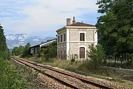 Train station | |
Location of Saint-Lattier | |
 Saint-Lattier  Saint-Lattier | |
| Coordinates: 45°05′19″N 5°12′05″E / 45.0886°N 5.2014°E | |
| Country | France |
| Region | Auvergne-Rhône-Alpes |
| Department | Isère |
| Arrondissement | Grenoble |
| Canton | Le Sud Grésivaudan |
| Government | |
| • Mayor (2020–2026) | Raymond Payen[1] |
| Area 1 | 18.17 km2 (7.02 sq mi) |
| Population | 1,442 |
| • Density | 79/km2 (210/sq mi) |
| Time zone | UTC+01:00 (CET) |
| • Summer (DST) | UTC+02:00 (CEST) |
| INSEE/Postal code | 38410 /38840 |
| Elevation | 144–406 m (472–1,332 ft) (avg. 178 m or 584 ft) |
| 1 French Land Register data, which excludes lakes, ponds, glaciers > 1 km2 (0.386 sq mi or 247 acres) and river estuaries. | |
Saint-Lattier (French pronunciation: [sɛ̃ latje]) is a commune in the Isère department in southeastern France.[3]
Population
| Year | Pop. | ±% p.a. |
|---|---|---|
| 1968 | 833 | — |
| 1975 | 775 | −1.03% |
| 1982 | 902 | +2.19% |
| 1990 | 1,028 | +1.65% |
| 1999 | 1,031 | +0.03% |
| 2009 | 1,255 | +1.99% |
| 2014 | 1,275 | +0.32% |
| 2020 | 1,418 | +1.79% |
| Source: INSEE[4] | ||
See also
References
- ↑ "Répertoire national des élus: les maires". data.gouv.fr, Plateforme ouverte des données publiques françaises (in French). 2 December 2020.
- ↑ "Populations légales 2021". The National Institute of Statistics and Economic Studies. 28 December 2023.
- ↑ INSEE commune file
- ↑ Population en historique depuis 1968, INSEE
Wikimedia Commons has media related to Saint-Lattier.
This article is issued from Wikipedia. The text is licensed under Creative Commons - Attribution - Sharealike. Additional terms may apply for the media files.