Reutenbourg
Riteburi | |
|---|---|
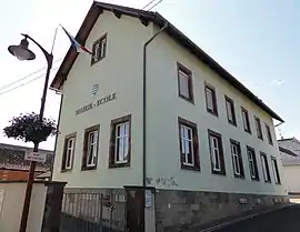 The town hall in Reutenbourg | |
 Coat of arms | |
Location of Reutenbourg | |
 Reutenbourg 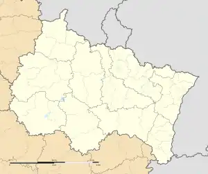 Reutenbourg | |
| Coordinates: 48°41′08″N 7°24′26″E / 48.6856°N 7.4072°E | |
| Country | France |
| Region | Grand Est |
| Department | Bas-Rhin |
| Arrondissement | Saverne |
| Canton | Saverne |
| Intercommunality | Pays de Saverne |
| Government | |
| • Mayor (2020–2026) | Frédéric Georger[1] |
| Area 1 | 4.4 km2 (1.7 sq mi) |
| Population | 395 |
| • Density | 90/km2 (230/sq mi) |
| Time zone | UTC+01:00 (CET) |
| • Summer (DST) | UTC+02:00 (CEST) |
| INSEE/Postal code | 67395 /67440 |
| Elevation | 211–351 m (692–1,152 ft) |
| 1 French Land Register data, which excludes lakes, ponds, glaciers > 1 km2 (0.386 sq mi or 247 acres) and river estuaries. | |
Reutenbourg (German: Reutenburg) is a commune in the Bas-Rhin department and Grand Est region of north-eastern France.[3]
Population
| Year | Pop. | ±% p.a. |
|---|---|---|
| 1968 | 365 | — |
| 1975 | 355 | −0.40% |
| 1982 | 328 | −1.12% |
| 1990 | 318 | −0.39% |
| 1999 | 303 | −0.54% |
| 2007 | 343 | +1.56% |
| 2012 | 400 | +3.12% |
| 2017 | 419 | +0.93% |
| Source: INSEE[4] | ||
See also
References
- ↑ "Répertoire national des élus: les maires". data.gouv.fr, Plateforme ouverte des données publiques françaises (in French). 2 December 2020.
- ↑ "Populations légales 2021". The National Institute of Statistics and Economic Studies. 28 December 2023.
- ↑ INSEE commune file
- ↑ Population en historique depuis 1968, INSEE
Wikimedia Commons has media related to Reutenbourg.
This article is issued from Wikipedia. The text is licensed under Creative Commons - Attribution - Sharealike. Additional terms may apply for the media files.