Handschuheim | |
|---|---|
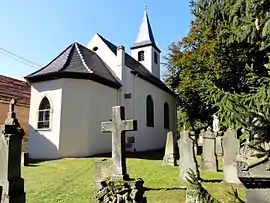 The Protestant church in Handschuheim | |
.svg.png.webp) Coat of arms | |
Location of Handschuheim | |
 Handschuheim 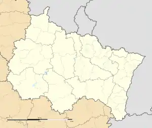 Handschuheim | |
| Coordinates: 48°36′13″N 7°34′41″E / 48.6036°N 7.5781°E | |
| Country | France |
| Region | Grand Est |
| Department | Bas-Rhin |
| Arrondissement | Saverne |
| Canton | Bouxwiller |
| Intercommunality | CC Kochersberg |
| Government | |
| • Mayor (2020–2026) | Alfred Schmitt[1] |
| Area 1 | 2.4 km2 (0.9 sq mi) |
| Population | 277 |
| • Density | 120/km2 (300/sq mi) |
| Time zone | UTC+01:00 (CET) |
| • Summer (DST) | UTC+02:00 (CEST) |
| INSEE/Postal code | 67181 /67117 |
| Elevation | 173–213 m (568–699 ft) |
| 1 French Land Register data, which excludes lakes, ponds, glaciers > 1 km2 (0.386 sq mi or 247 acres) and river estuaries. | |
Handschuheim is a commune in the Bas-Rhin department in Grand Est in north-eastern France.[3]
It lies a few kilometres to the west of Strasbourg along the old national road RN4.
See also
References
- ↑ "Répertoire national des élus: les maires". data.gouv.fr, Plateforme ouverte des données publiques françaises (in French). 2 December 2020.
- ↑ "Populations légales 2021". The National Institute of Statistics and Economic Studies. 28 December 2023.
- ↑ INSEE commune file
External links
Wikimedia Commons has media related to Handschuheim.
This article is issued from Wikipedia. The text is licensed under Creative Commons - Attribution - Sharealike. Additional terms may apply for the media files.