Gyál | |
|---|---|
 Flag  Coat of arms | |
 Gyál Location of Gyál | |
| Coordinates: 47°23′10″N 19°13′09″E / 47.38607°N 19.21922°E | |
| Country | |
| County | Pest |
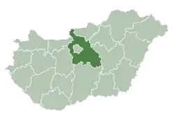
| District | Gyál |
| Area | |
| • Total | 24.93 km2 (9.63 sq mi) |
| Population (2007) | |
| • Total | 22,552 |
| • Density | 873.12/km2 (2,261.4/sq mi) |
| Time zone | UTC+1 (CET) |
| • Summer (DST) | UTC+2 (CEST) |
| Postal code | 2360 |
| Area code | (+36) 29 |
| Website | www |
Gyál [ɟaːl] is a town in Pest county, Budapest metropolitan area, Hungary. It has a population of 22,552. In 1949 it had only 4,104 inhabitants. During the socialist era, Gyál become a garden suburb of Budapest.
Twin towns – sister cities
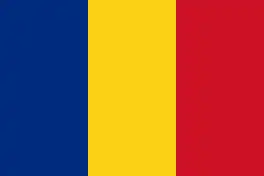 Chibed, Romania
References
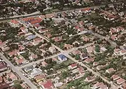
Aerial view of Gyál
- ↑ "Testvértelepülés" (in Hungarian). Gyál. Retrieved 2021-04-07.
External links
Wikimedia Commons has media related to Gyál.
- Official website in Hungarian
- Street map (in Hungarian)
| Towns (2) | ||
|---|---|---|
| Large village (1) | ||
| Village (1) | ||
This article is issued from Wikipedia. The text is licensed under Creative Commons - Attribution - Sharealike. Additional terms may apply for the media files.