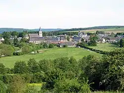
Wellin
| |
|---|---|
 | |
.svg.png.webp) Coat of arms | |
Location of Wellin | |
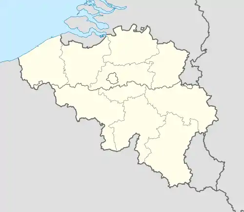 Wellin Location in Belgium
Location of Wellin in Luxembourg province 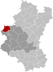 | |
| Coordinates: 50°4.9′N 5°6.8′E / 50.0817°N 5.1133°E | |
| Country | |
| Community | French Community |
| Region | Wallonia |
| Province | Luxembourg |
| Arrondissement | Neufchâteau |
| Government | |
| • Mayor | Benoît Closson |
| • Governing party/ies | Wellin dem@in |
| Area | |
| • Total | 67.86 km2 (26.20 sq mi) |
| Population (2018-01-01)[1] | |
| • Total | 3,064 |
| • Density | 45/km2 (120/sq mi) |
| Postal codes | 6920-6922, 6924 |
| NIS code | 84075 |
| Area codes | 084 |
| Website | wellin.be |
Wellin (French pronunciation: [wɛlɛ̃]; Walloon: Welin) is a municipality of Wallonia located in the province of Luxembourg, Belgium.
On 1 January 2007 the municipality, which covers 67.52 km2, had 2,958 inhabitants, giving a population density of 43.8 inhabitants per km2.
The municipality consists of the following districts: Chanly, Halma, Lomprez, Sohier, and Wellin. Other population centers include: Barzin, Froidlieu, Fays-Famenne, and Neupont.
References
- ↑ "Wettelijke Bevolking per gemeente op 1 januari 2018". Statbel. Retrieved 9 March 2019.
External links
 Media related to Wellin at Wikimedia Commons
- Official website (in French)
- Bibliotheque communale de Wellin (in French)
- Graffiti from Wellin
Municipalities of the province of Luxembourg, Wallonia | ||
|---|---|---|
| Arlon | 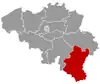 | |
| Bastogne | ||
| Marche-en-Famenne | ||
| Neufchâteau | ||
| Virton | ||
Bold indicates cities | ||
This article is issued from Wikipedia. The text is licensed under Creative Commons - Attribution - Sharealike. Additional terms may apply for the media files.