Saint-Cergues | |
|---|---|
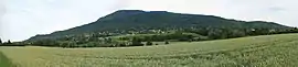 The landscape around Saint-Cergues | |
 Coat of arms | |
Location of Saint-Cergues | |
 Saint-Cergues  Saint-Cergues | |
| Coordinates: 46°14′08″N 6°19′18″E / 46.2356°N 6.3217°E | |
| Country | France |
| Region | Auvergne-Rhône-Alpes |
| Department | Haute-Savoie |
| Arrondissement | Saint-Julien-en-Genevois |
| Canton | Gaillard |
| Intercommunality | Annemasse – Les Voirons |
| Government | |
| • Mayor (2020–2026) | Gabriel Doublet[1] |
| Area 1 | 12.55 km2 (4.85 sq mi) |
| Population | 3,714 |
| • Density | 300/km2 (770/sq mi) |
| Demonym | Saint-cerguois |
| Time zone | UTC+01:00 (CET) |
| • Summer (DST) | UTC+02:00 (CEST) |
| INSEE/Postal code | 74229 /74140 |
| Elevation | 486–1,480 m (1,594–4,856 ft) |
| 1 French Land Register data, which excludes lakes, ponds, glaciers > 1 km2 (0.386 sq mi or 247 acres) and river estuaries. | |
Saint-Cergues (French pronunciation: [sɛ̃ sɛʁɡ]; Arpitan: San-Fargo) is a commune in the Haute-Savoie department in the Auvergne-Rhône-Alpes region in south-eastern France.
Population
| Year | Pop. | ±% p.a. |
|---|---|---|
| 1968 | 1,291 | — |
| 1975 | 1,830 | +5.11% |
| 1982 | 2,088 | +1.90% |
| 1990 | 2,337 | +1.42% |
| 1999 | 2,513 | +0.81% |
| 2007 | 3,001 | +2.24% |
| 2012 | 3,297 | +1.90% |
| 2017 | 3,613 | +1.85% |
| Source: INSEE[3] | ||
See also
References
- ↑ "Répertoire national des élus: les maires". data.gouv.fr, Plateforme ouverte des données publiques françaises (in French). 2 December 2020.
- ↑ "Populations légales 2021". The National Institute of Statistics and Economic Studies. 28 December 2023.
- ↑ Population en historique depuis 1968, INSEE
Wikimedia Commons has media related to Saint-Cergues.
This article is issued from Wikipedia. The text is licensed under Creative Commons - Attribution - Sharealike. Additional terms may apply for the media files.