Poisy | |
|---|---|
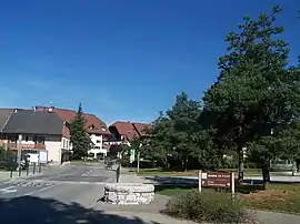 A view of the centre of Poisy | |
 Coat of arms | |
Location of Poisy | |
 Poisy  Poisy | |
| Coordinates: 45°55′18″N 6°03′44″E / 45.9216°N 06.0622°E | |
| Country | France |
| Region | Auvergne-Rhône-Alpes |
| Department | Haute-Savoie |
| Arrondissement | Annecy |
| Canton | Annecy-1 |
| Intercommunality | CA Grand Annecy |
| Government | |
| • Mayor (2020–2026) | Pierre Bruyère[1] |
| Area 1 | 11.33 km2 (4.37 sq mi) |
| Population | 8,773 |
| • Density | 770/km2 (2,000/sq mi) |
| Demonym | Poisilliens |
| Time zone | UTC+01:00 (CET) |
| • Summer (DST) | UTC+02:00 (CEST) |
| INSEE/Postal code | 74213 /74330 |
| Elevation | 384–675 m (1,260–2,215 ft) |
| Website | www |
| 1 French Land Register data, which excludes lakes, ponds, glaciers > 1 km2 (0.386 sq mi or 247 acres) and river estuaries. | |
Poisy (French pronunciation: [pwazi]; Arpitan: Pouêzy) is a commune in the Haute-Savoie department in the Auvergne-Rhône-Alpes region in south-eastern France. It is part of the urban area of Annecy.[3]
Geography
The Fier forms the commune's southern border.
Population
| Year | Pop. | ±% p.a. |
|---|---|---|
| 1968 | 1,717 | — |
| 1975 | 2,407 | +4.94% |
| 1982 | 2,902 | +2.71% |
| 1990 | 4,316 | +5.09% |
| 1999 | 5,487 | +2.70% |
| 2007 | 6,310 | +1.76% |
| 2012 | 7,017 | +2.15% |
| 2017 | 8,124 | +2.97% |
| Source: INSEE[4] | ||
See also
References
- ↑ "Répertoire national des élus: les maires". data.gouv.fr, Plateforme ouverte des données publiques françaises (in French). 2 December 2020.
- ↑ "Populations légales 2021". The National Institute of Statistics and Economic Studies. 28 December 2023.
- ↑ Unité urbaine 2020 d'Annecy (74601), INSEE
- ↑ Population en historique depuis 1968, INSEE
Wikimedia Commons has media related to Poisy.
This article is issued from Wikipedia. The text is licensed under Creative Commons - Attribution - Sharealike. Additional terms may apply for the media files.