Roccaspinalveti | |
|---|---|
| Comune di Roccaspinalveti | |
 | |
Location of Roccaspinalveti | |
 Roccaspinalveti Location of Roccaspinalveti in Italy 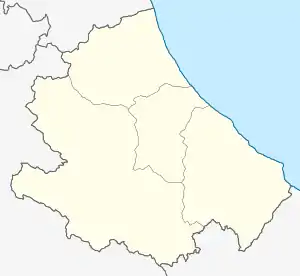 Roccaspinalveti Roccaspinalveti (Abruzzo) | |
| Coordinates: 41°56′N 14°28′E / 41.933°N 14.467°E | |
| Country | Italy |
| Region | Abruzzo |
| Province | Chieti (CH) |
| Frazioni | Vedi elenco |
| Area | |
| • Total | 32.92 km2 (12.71 sq mi) |
| Elevation | 731 m (2,398 ft) |
| Population (2004)[2] | |
| • Total | 1,607 |
| • Density | 49/km2 (130/sq mi) |
| Demonym | Roccolani |
| Time zone | UTC+1 (CET) |
| • Summer (DST) | UTC+2 (CEST) |
| Postal code | 66050 |
| Dialing code | 0873 |
| ISTAT code | 069076 |
| Patron saint | San Pio |
| Saint day | 11 July |
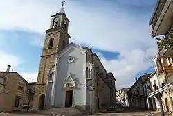
Roccaspinalveti is a comune and town in the Province of Chieti in the Abruzzo region of Italy.
References
Wikimedia Commons has media related to Roccaspinalveti.
- ↑ "Superficie di Comuni Province e Regioni italiane al 9 ottobre 2011". Italian National Institute of Statistics. Retrieved 16 March 2019.
- ↑ All demographics and other statistics from the Italian statistical institute (Istat)
This article is issued from Wikipedia. The text is licensed under Creative Commons - Attribution - Sharealike. Additional terms may apply for the media files.