40°46′N 44°00′E / 40.767°N 44.000°E
Hovit
Հովիտ | |
|---|---|
 Hovit 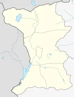 Hovit | |
| Coordinates: 40°46′N 44°00′E / 40.767°N 44.000°E | |
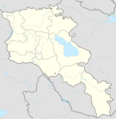
| Country | Armenia |
| Province | Shirak |
| Municipality | Akhuryan |
| Population (2001) | |
| • Total | 528 |
| Time zone | UTC+4 |
| • Summer (DST) | UTC+5 |
Hovit (Armenian: Հովիտ) is a village in the Akhuryan Municipality of the Shirak Province of Armenia.
Demographics
| Year | Pop. | ±% p.a. |
|---|---|---|
| 1831 | 101 | — |
| 1897 | 608 | +2.76% |
| 1926 | 504 | −0.64% |
| 1939 | 578 | +1.06% |
| 1959 | 543 | −0.31% |
| 1970 | 538 | −0.08% |
| 1979 | 492 | −0.99% |
| 1989 | 442 | −1.07% |
| 2001 | 538 | +1.65% |
| 2004 | 558 | +1.22% |
| Source: [1] | ||
References
- ↑ Հայաստանի Հանրապետության բնակավայրերի բառարան [Republic of Armenia settlements dictionary] (PDF) (in Armenian). Yerevan: Cadastre Committee of the Republic of Armenia. 2008. Archived from the original (PDF) on 11 March 2018.
- Hovit at GEOnet Names Server
- Report of the results of the 2001 Armenian Census, Statistical Committee of Armenia
Capital: Gyumri | ||
| Urban settlements | 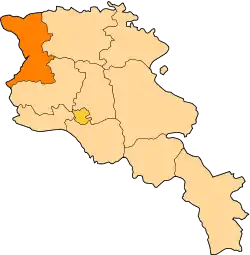 | |
| Akhuryan Municipality | ||
| Amasia Municipality | ||
| Ani Municipality | ||
| Artik Municipality | ||
| Ashotsk Municipality | ||
This article is issued from Wikipedia. The text is licensed under Creative Commons - Attribution - Sharealike. Additional terms may apply for the media files.