Otterthal | |
|---|---|
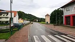 Street in Otterthal | |
 Coat of arms | |
 Otterthal Location within Austria | |
| Coordinates: 47°37′00″N 15°55′00″E / 47.61667°N 15.91667°E | |
| Country | Austria |
| State | Lower Austria |
| District | Neunkirchen |
| Government | |
| • Mayor | Karl Mayerhofer (ÖVP) |
| Area | |
| • Total | 6.18 km2 (2.39 sq mi) |
| Elevation | 632 m (2,073 ft) |
| Population (2018-01-01)[2] | |
| • Total | 592 |
| • Density | 96/km2 (250/sq mi) |
| Time zone | UTC+1 (CET) |
| • Summer (DST) | UTC+2 (CEST) |
| Postal code | 2880 |
| Area code | 02641 |
| Vehicle registration | NK |
| Website | www.otterthal.at |
Otterthal is a municipality in the Industrieviertel of Lower Austria, Austria. 61.72 percent of the municipality is forested. There are 25 agricultural companies. 266 persons are employed. The activity rate was 48.31%.
Population
| Year | Pop. | ±% |
|---|---|---|
| 1971 | 453 | — |
| 1981 | 526 | +16.1% |
| 1991 | 628 | +19.4% |
| 2001 | 563 | −10.4% |
References
- ↑ "Dauersiedlungsraum der Gemeinden Politischen Bezirke und Bundesländer - Gebietsstand 1.1.2018". Statistics Austria. Retrieved 10 March 2019.
- ↑ "Einwohnerzahl 1.1.2018 nach Gemeinden mit Status, Gebietsstand 1.1.2018". Statistics Austria. Retrieved 9 March 2019.
This article is issued from Wikipedia. The text is licensed under Creative Commons - Attribution - Sharealike. Additional terms may apply for the media files.