Old Tening
Tening (Old) | |
|---|---|
village | |
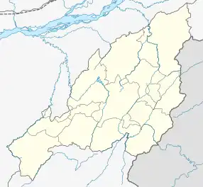 Old Tening Location in Nagaland, India  Old Tening Old Tening (India) | |
| Coordinates: 25°18′43″N 93°36′33″E / 25.312056°N 93.609223°E | |
| Country | India |
| State | Nagaland |
| District | Peren |
| Circle | Tening |
| Population (2011) | |
| • Total | 622 |
| Time zone | UTC+5:30 (IST) |
| Census code | 268385 |
Old Tening is a village in the Peren district of Nagaland, India. It is located in the Tening Circle.[1]
Demographics
According to the 2011 census of India, Old Tening has 103 households. The effective literacy rate (i.e. the literacy rate of population excluding children aged 6 and below) is 69.2%.[2]
| Total | Male | Female | |
|---|---|---|---|
| Population | 622 | 312 | 310 |
| Children aged below 6 years | 57 | 27 | 30 |
| Scheduled caste | 0 | 0 | 0 |
| Scheduled tribe | 611 | 305 | 306 |
| Literates | 391 | 213 | 178 |
| Workers (all) | 364 | 175 | 189 |
| Main workers (total) | 273 | 131 | 142 |
| Main workers: Cultivators | 218 | 99 | 119 |
| Main workers: Agricultural labourers | 0 | 0 | 0 |
| Main workers: Household industry workers | 1 | 1 | 0 |
| Main workers: Other | 54 | 31 | 23 |
| Marginal workers (total) | 91 | 44 | 47 |
| Marginal workers: Cultivators | 6 | 3 | 3 |
| Marginal workers: Agricultural labourers | 1 | 1 | 0 |
| Marginal workers: Household industry workers | 5 | 2 | 3 |
| Marginal workers: Others | 79 | 38 | 41 |
| Non-workers | 258 | 137 | 121 |
References
- ↑ "Nagaland revenue village directory" (PDF). Archived from the original (PDF) on 4 March 2016. Retrieved 25 July 2015.
- 1 2 "District Census Handbook - Peren" (PDF). 2011 Census of India. Directorate of Census Operations, Nagaland. Retrieved 22 July 2015.
This article is issued from Wikipedia. The text is licensed under Creative Commons - Attribution - Sharealike. Additional terms may apply for the media files.