Miszla | |
|---|---|
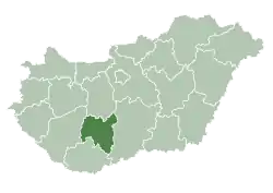
 Miszla Location of Miszla | |
| Coordinates: 46°37′50″N 18°28′47″E / 46.63058°N 18.47968°E | |
| Country | |
| County | Tolna |
| Area | |
| • Total | 34.72 km2 (13.41 sq mi) |
| Population (2004) | |
| • Total | 332 |
| • Density | 9.56/km2 (24.8/sq mi) |
| Time zone | UTC+1 (CET) |
| • Summer (DST) | UTC+2 (CEST) |
| Postal code | 7065 |
| Area code | 74 |
Miszla is a village in Tolna County, Hungary.
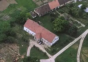
Aerial photography of Miszla
External links
- Street map (in Hungarian)
| City with county rights |
|   |
|---|---|---|
| Towns | ||
| Large villages | ||
| Villages |
| |
| Other topics |
| |
This article is issued from Wikipedia. The text is licensed under Creative Commons - Attribution - Sharealike. Additional terms may apply for the media files.