Machault | |
|---|---|
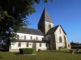 The church in Machault | |
 Coat of arms | |
Location of Machault | |
 Machault 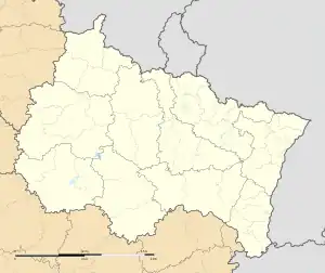 Machault | |
| Coordinates: 49°21′20″N 4°30′00″E / 49.3556°N 4.5°E | |
| Country | France |
| Region | Grand Est |
| Department | Ardennes |
| Arrondissement | Vouziers |
| Canton | Attigny |
| Intercommunality | Argonne Ardennaise |
| Government | |
| • Mayor (2020–2026) | Chantal Pierot[1] |
| Area 1 | 16.58 km2 (6.40 sq mi) |
| Population | 503 |
| • Density | 30/km2 (79/sq mi) |
| Time zone | UTC+01:00 (CET) |
| • Summer (DST) | UTC+02:00 (CEST) |
| INSEE/Postal code | 08264 /08310 |
| Elevation | 114–171 m (374–561 ft) (avg. 140 m or 460 ft) |
| 1 French Land Register data, which excludes lakes, ponds, glaciers > 1 km2 (0.386 sq mi or 247 acres) and river estuaries. | |
Machault (French pronunciation: [maʃo] ⓘ) is a commune in the Ardennes department in northern France.
Population
| Year | Pop. | ±% p.a. |
|---|---|---|
| 1968 | 551 | — |
| 1975 | 511 | −1.07% |
| 1982 | 440 | −2.11% |
| 1990 | 459 | +0.53% |
| 1999 | 437 | −0.54% |
| 2007 | 495 | +1.57% |
| 2012 | 503 | +0.32% |
| 2017 | 505 | +0.08% |
| Source: INSEE[3] | ||
See also
References
- ↑ "Répertoire national des élus: les maires". data.gouv.fr, Plateforme ouverte des données publiques françaises (in French). 2 December 2020.
- ↑ "Populations légales 2021". The National Institute of Statistics and Economic Studies. 28 December 2023.
- ↑ Population en historique depuis 1968, INSEE
Wikimedia Commons has media related to Machault, Ardennes.
This article is issued from Wikipedia. The text is licensed under Creative Commons - Attribution - Sharealike. Additional terms may apply for the media files.