La Haye-de-Routot | |
|---|---|
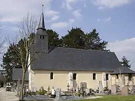 The church of Notre-Dame in La Haye-de-Routot | |
Location of La Haye-de-Routot | |
 La Haye-de-Routot 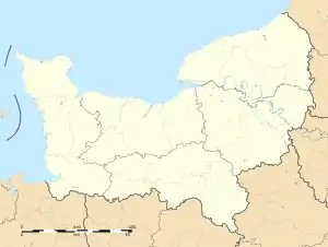 La Haye-de-Routot | |
| Coordinates: 49°24′19″N 0°43′42″E / 49.4053°N 0.7283°E | |
| Country | France |
| Region | Normandy |
| Department | Eure |
| Arrondissement | Bernay |
| Canton | Bourg-Achard |
| Government | |
| • Mayor (2020–2026) | Jacques Binet[1] |
| Area 1 | 2.51 km2 (0.97 sq mi) |
| Population | 293 |
| • Density | 120/km2 (300/sq mi) |
| Time zone | UTC+01:00 (CET) |
| • Summer (DST) | UTC+02:00 (CEST) |
| INSEE/Postal code | 27319 /27350 |
| Elevation | 70–132 m (230–433 ft) (avg. 131 m or 430 ft) |
| 1 French Land Register data, which excludes lakes, ponds, glaciers > 1 km2 (0.386 sq mi or 247 acres) and river estuaries. | |
La Haye-de-Routot (French pronunciation: [la ɛ də ʁuto]) is a commune in the Eure department in north-western France. It is located on the border of Seine-Maritime, south of the Forêt de Brotonne.
Population
| Year | Pop. | ±% p.a. |
|---|---|---|
| 1968 | 148 | — |
| 1975 | 172 | +2.17% |
| 1982 | 197 | +1.96% |
| 1990 | 227 | +1.79% |
| 1999 | 256 | +1.34% |
| 2007 | 256 | +0.00% |
| 2012 | 286 | +2.24% |
| 2017 | 305 | +1.29% |
| Source: INSEE[3] | ||
Sights
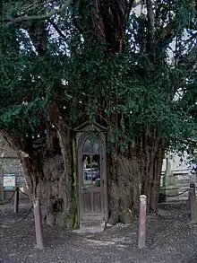
The Chapelle de Sainte-Anne in a yew tree.
- Shoe museum
- The tiny Chapelle de Sainte-Anne which is carved into a yew tree
See also
References
- ↑ "Répertoire national des élus: les maires" (in French). data.gouv.fr, Plateforme ouverte des données publiques françaises. 13 September 2022.
- ↑ "Populations légales 2021". The National Institute of Statistics and Economic Studies. 28 December 2023.
- ↑ Population en historique depuis 1968, INSEE
Wikimedia Commons has media related to La Haye-de-Routot.
This article is issued from Wikipedia. The text is licensed under Creative Commons - Attribution - Sharealike. Additional terms may apply for the media files.