Houquetot | |
|---|---|
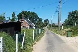 A road in Houquetot | |
Location of Houquetot | |
 Houquetot 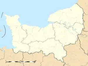 Houquetot | |
| Coordinates: 49°36′19″N 0°23′23″E / 49.6053°N 0.3897°E | |
| Country | France |
| Region | Normandy |
| Department | Seine-Maritime |
| Arrondissement | Le Havre |
| Canton | Saint-Romain-de-Colbosc |
| Intercommunality | CC Campagne de Caux |
| Government | |
| • Mayor (2020–2026) | David Jézéquel[1] |
| Area 1 | 4.09 km2 (1.58 sq mi) |
| Population | 340 |
| • Density | 83/km2 (220/sq mi) |
| Time zone | UTC+01:00 (CET) |
| • Summer (DST) | UTC+02:00 (CEST) |
| INSEE/Postal code | 76368 /76110 |
| Elevation | 104–132 m (341–433 ft) (avg. 119 m or 390 ft) |
| 1 French Land Register data, which excludes lakes, ponds, glaciers > 1 km2 (0.386 sq mi or 247 acres) and river estuaries. | |
Houquetot (French pronunciation: [ukto]) is a commune in the Seine-Maritime department in the Normandy region in northern France.
Geography
A small farming village situated in the Pays de Caux, some 12 miles (19 km) northeast of Le Havre, near the junction of the D252 and D910 roads.
Population
| Year | Pop. | ±% p.a. |
|---|---|---|
| 1968 | 203 | — |
| 1975 | 168 | −2.67% |
| 1982 | 226 | +4.33% |
| 1990 | 268 | +2.15% |
| 1999 | 289 | +0.84% |
| 2007 | 302 | +0.55% |
| 2012 | 354 | +3.23% |
| 2017 | 353 | −0.06% |
| Source: INSEE[3] | ||
Places of interest
- The church of St. Aubin, dating from the nineteenth century.
- A sixteenth century dovecote.
See also
References
- ↑ "Répertoire national des élus: les maires" (in French). data.gouv.fr, Plateforme ouverte des données publiques françaises. 13 September 2022.
- ↑ "Populations légales 2021". The National Institute of Statistics and Economic Studies. 28 December 2023.
- ↑ Population en historique depuis 1968, INSEE
Wikimedia Commons has media related to Houquetot.
This article is issued from Wikipedia. The text is licensed under Creative Commons - Attribution - Sharealike. Additional terms may apply for the media files.