Hariyawan
Hariāwān | |
|---|---|
Populated place | |
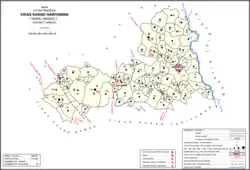 Map showing Hariyawan (#064) in Hariyawan CD block | |
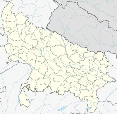 Hariyawan Location in Uttar Pradesh, India  Hariyawan Hariyawan (India) | |
| Coordinates: 27°31′43″N 80°10′26″E / 27.5286°N 80.1739°E[1] | |
| Country | India |
| State | Uttar Pradesh |
| District | Hardoi |
| Area | |
| • Total | 3.10 km2 (1.20 sq mi) |
| Population (2011)[2] | |
| • Total | 2,997 |
| • Density | 970/km2 (2,500/sq mi) |
| Languages | |
| • Official | Hindi |
| Time zone | UTC+5:30 (IST) |
Hariyawan is a village and corresponding community development block in Hardoi district of Uttar Pradesh, India.[2] It hosts a market on Wednesdays and Sundays.[3][4] The main staple foods here are wheat and rice.[3][4] As of 2011, its population is 2,997, in 508 households.[2]
Demographic history
The 1961 census recorded Hariyawan as comprising three hamlets, with a total population of 1,573 (832 male and 746 female), in 247 households and 221 physical houses.[5] The area of the village was given as 766 acres.[5]
The 1981 census recorded Hariyawan as having a population of 2,099, in 384 households, and covering an area of 310.00 hectares.[4]
Villages
Hariyawan CD block has the following 92 villages:[2]
| Village name | Total land area (hectares) | Population (in 2011) |
|---|---|---|
| Kheriya | 164.1 | 1,487 |
| Modipur | 242.6 | 1,228 |
| Atbaha | 90.8 | 241 |
| Rohai | 52.9 | 1,072 |
| Pipari | 889.8 | 4,623 |
| Tolwa Antdanpur | 119.8 | 8,041 |
| Kalwari Grant | 48 | 278 |
| Atwa Asigaon | 784.9 | 4,446 |
| Labhi | 94.7 | 574 |
| Bijgawan | 536.3 | 3,340 |
| Shakurabad | 70.2 | 273 |
| Sadhinava | 628.5 | 3,327 |
| Khajuha | 44.2 | 120 |
| Lodhaura | 41.9 | 123 |
| Mavaiya | 957.2 | 4,985 |
| Seva | 260.2 | 1,374 |
| Kurseli | 1,869.3 | 10,404 |
| Marai | 727.7 | 3,010 |
| Akbarpur | 64 | 726 |
| Jatuli | 181 | 888 |
| Gadaipur | 71.1 | 643 |
| Lohkanpur | 216 | 559 |
| Hariyawan (block headquarters) | 310 | 2,997 |
| Korigawan | 130 | 954 |
| Madrawan | 425.7 | 2,526 |
| Biram Khera | 44.7 | 398 |
| Deoriya Prasidh Nagar | 143.1 | 817 |
| Shahpur Binora | 800.1 | 3,219 |
| Kapurpur Chaudhi | 153 | 1,415 |
| Ahemdi | 282 | 1,166 |
| Utara | 638.5 | 3,572 |
| Kaimpur | 195.6 | 1,258 |
| Hinguapur | 132.8 | 1,203 |
| Murwan | 306.5 | 1,734 |
| Baherda | 109.7 | 637 |
| Jafarpur | 126.1 | 662 |
| Achuapur | 118.6 | 1,111 |
| Majhigawan Amarnath | 95.4 | 564 |
| Bhadeura | 566 | 4,297 |
| Alawalpur | 208 | 1,186 |
| Teni | 632.3 | 3,996 |
| Paidhai | 198.7 | 1,388 |
| Nayagaon Navav | 48.9 | 467 |
| Daulatpur | 364.5 | 2,510 |
| Sarkhna | 149.1 | 926 |
| Mahmudpur Baijnath | 165.3 | 330 |
| Jalalpur | 87.1 | 997 |
| Thamarwa | 253.4 | 1,995 |
| Bigha Rampur | 83.9 | 518 |
| Padri | 423.6 | 3,929 |
| Muradpur | 198.8 | 1,755 |
| Majhiya | 977.6 | 7,060 |
| Lehna | 359.6 | 2,759 |
| Hillapur | 190.8 | 2,843 |
| Bakhariya | 190.8 | 2,843 |
| Tandauna | 337.6 | 2,924 |
| Raniyamau | 119.5 | 1,111 |
| Kathethiya | 202.5 | 1,879 |
| Katarpur | 153.5 | 489 |
| Kathigara | 496.5 | 2,384 |
| Manipur | 287.1 | 1,247 |
| Aliyapur | 91.3 | 1,024 |
| Burdhagaon | 599.4 | 4,368 |
| Dhoviya | 509.1 | 2,365 |
| Barmahaula | 163.8 | 1,533 |
| Dulhapur | 248.7 | 2,183 |
| Khateli | 293.4 | 3,042 |
| Akohara | 183.9 | 867 |
| Purwa Hafijudinpur | 208.4 | 1,583 |
| Jareli | 672.2 | 4,931 |
| Bagocha | 338.2 | 2,291 |
| Kaliyani | 253.2 | 1,791 |
| Bajehra | 288.4 | 2,316 |
| Sirsa | 611 | 2,696 |
| Tandor | 290.4 | 2,962 |
| Aharapur | 69.6 | 317 |
| Sariyan | 300.5 | 814 |
| Barkatpur | 226.5 | 363 |
| Gopamau (Gramin) | 864.9 | 0 |
| Dariyabad | 238 | 0 |
| Rahimpur | 400.9 | 1,948 |
| Kachnari | 413.1 | 722 |
| Bajidnagar | 74.8 | 0 |
| Lalpur | 72.7 | 523 |
| Shahjad Nagar | 58.5 | 179 |
| Fakirabad | 185 | 819 |
| Peng | 541 | 3,835 |
| Agaulapur | 329 | 1,513 |
| Kushalpur | 134.8 | 0 |
| Babupur | 330.9 | 1,117 |
| Gajadharpur | 220.2 | 502 |
| Arwapur | 301.2 | 1,969 |
References
- ↑ "Geographic Names Search WebApp". Search for "Hariawan" here.
- 1 2 3 4 5 "Census of India 2011: Uttar Pradesh District Census Handbook - Hardoi, Part A (Village and Town Directory)" (PDF). Census 2011 India. pp. 317–34. Retrieved 8 June 2021.
- 1 2 Census 1971 Uttar Pradesh: District Census Handbook Part X-A: Village & Town Directory, District Hardoi (PDF). 1972. pp. 86–7. Retrieved 8 June 2021.
- 1 2 3 Census 1981 Uttar Pradesh: District Census Handbook Part XIII-A: Village & Town Directory, District Hardoi (PDF). 1982. pp. 120–1. Retrieved 8 June 2021.
- 1 2 Census 1961: District Census Handbook, Uttar Pradesh (36 - Hardoi District) (PDF). Lucknow. 1965. pp. lviii-lix of section "Hardoi Tahsil". Retrieved 8 June 2021.
{{cite book}}: CS1 maint: location missing publisher (link)
This article is issued from Wikipedia. The text is licensed under Creative Commons - Attribution - Sharealike. Additional terms may apply for the media files.