Hamur District | |
|---|---|
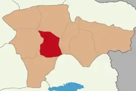 Map showing Hamur District in Ağrı Province | |
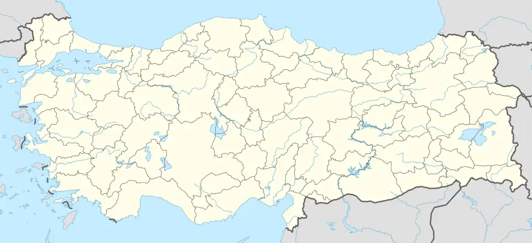 Hamur District Location in Turkey | |
| Coordinates: 39°37′N 43°00′E / 39.617°N 43.000°E | |
| Country | Turkey |
| Province | Ağrı |
| Seat | Hamur |
| Government | |
| • Kaymakam | Ali Yıldırım |
| Area | 873 km2 (337 sq mi) |
| Population (2021) | 17,106 |
| • Density | 20/km2 (51/sq mi) |
| Time zone | TRT (UTC+3) |
| Website | www |
Hamur District is a district of Ağrı Province of Turkey. Its seat is the town Hamur.[1] Its area is 873 km2,[2] and its population is 17,106 (2021).[3]
Composition
There is one municipality in Hamur District:[1][4]
There are 46 villages in Hamur District:[5]
- Abdiçıkmaz
- Adımova
- Akyurt
- Alakoyun
- Aşağıaladağ
- Aşağıderedibi
- Aşağıgözlüce
- Aşağıkarabal
- Aşağıyenigün
- Ayvacık
- Baldere
- Beklemez
- Ceylanlı
- Çağlayan
- Danakıran
- Demirkapı
- Ekincik
- Erdoğan
- Esenören
- Gültepe
- Gümüşkuşak
- Kaçmaz
- Kamışlı
- Kandildağı
- Karadoğu
- Karakazan
- Karaseyitali
- Karlıca
- Kaynaklı
- Kılıç
- Köşkköy
- Nallıkonak
- Özdirek
- Sarıbuğday
- Seslidoğan
- Seyithanbey
- Soğanlıtepe
- Süleymankümbet
- Tükenmez
- Uğurtaş
- Yapılı
- Yoğunhisar
- Yukarıaladağ
- Yukarıgözlüce
- Yukarıyenigün
- Yuvacık
References
- 1 2 İlçe Belediyesi, Turkey Civil Administration Departments Inventory. Retrieved 12 January 2023.
- ↑ "İl ve İlçe Yüz ölçümleri". General Directorate of Mapping. Retrieved 12 January 2023.
- ↑ "Address-based population registration system (ADNKS) results dated 31 December 2021" (XLS) (in Turkish). TÜİK. Retrieved 12 January 2023.
- ↑ Belde Belediyesi, Turkey Civil Administration Departments Inventory. Retrieved 16 January 2023.
- ↑ Köy, Turkey Civil Administration Departments Inventory. Retrieved 15 January 2023.
Hamur District in Ağrı Province of Turkey | |||||||||||||||||||||||||||
|---|---|---|---|---|---|---|---|---|---|---|---|---|---|---|---|---|---|---|---|---|---|---|---|---|---|---|---|
| Districts | 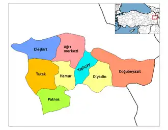 Districts of Ağrı | ||||||||||||||||||||||||||
| |||||||||||||||||||||||||||
Metropolitan municipalities are bolded. | |||||||||||||||||||||||||||
This article is issued from Wikipedia. The text is licensed under Creative Commons - Attribution - Sharealike. Additional terms may apply for the media files.