Bankass | |
|---|---|
 | |
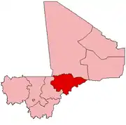
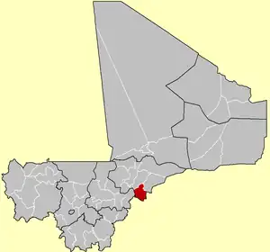 Location of the Cercle of Bankass in Mali | |
| Country | |
| Region | Mopti Region |
| Capital | Bankass |
| Admin HQ (Chef-lieu) | Bankass |
| Area | |
| • Total | 9,054 km2 (3,496 sq mi) |
| Population (2009 census)[2] | |
| • Total | 263,446 |
| • Density | 29/km2 (75/sq mi) |
| Time zone | UTC+0 (GMT) |
Bankass Cercle is an administrative subdivision of the Mopti Region of Mali. The administrative center (chef-lieu) is at the town of Bankass.
The Cercle is divided into 12 rural communes:
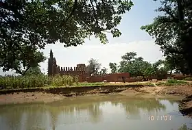
Kani-Kombole Mosque
References
- ↑ Synthèsis des Plans de Securité Alimentaire des Communes du Cercle Bankass 2006-2010 (PDF) (in French), Commissariat à la Sécurité Alimentaire, République du Mali, USAID-Mali, 2006, archived from the original (PDF) on 2011-07-26, retrieved 2011-02-02.
- ↑ Resultats Provisoires RGPH 2009 (Région de Mopti) (PDF) (in French), République de Mali: Institut National de la Statistique, archived from the original (PDF) on 2012-07-27.
| Kayes Region |  | |
|---|---|---|
| Koulikoro Region | ||
| Sikasso Region | ||
| Ségou Region | ||
| Mopti Region | ||
| Tombouctou Region | ||
| Gao Region | ||
| Kidal Region | ||
| Bamako Capital District | ||
| Ménaka Region | ||
| Taoudénit Region | ||
13°40′N 3°40′W / 13.667°N 3.667°W
This article is issued from Wikipedia. The text is licensed under Creative Commons - Attribution - Sharealike. Additional terms may apply for the media files.