Arthel | |
|---|---|
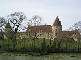 The Château de la Motte, in Arthel | |
Location of Arthel | |
 Arthel 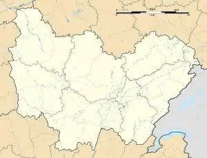 Arthel | |
| Coordinates: 47°14′43″N 3°24′35″E / 47.2453°N 3.4097°E | |
| Country | France |
| Region | Bourgogne-Franche-Comté |
| Department | Nièvre |
| Arrondissement | Cosne-Cours-sur-Loire |
| Canton | La Charité-sur-Loire |
| Intercommunality | CC Les Bertranges |
| Government | |
| • Mayor (2020–2026) | Marc Fauche[1] |
| Area 1 | 7.73 km2 (2.98 sq mi) |
| Population | 92 |
| • Density | 12/km2 (31/sq mi) |
| Time zone | UTC+01:00 (CET) |
| • Summer (DST) | UTC+02:00 (CEST) |
| INSEE/Postal code | 58013 /58700 |
| Elevation | 229–353 m (751–1,158 ft) |
| 1 French Land Register data, which excludes lakes, ponds, glaciers > 1 km2 (0.386 sq mi or 247 acres) and river estuaries. | |
Arthel (French pronunciation: [aʁtɛl]) is a commune in the Nièvre department in central France.[3]
Population
| Year | Pop. | ±% p.a. |
|---|---|---|
| 1968 | 161 | — |
| 1975 | 151 | −0.91% |
| 1982 | 120 | −3.23% |
| 1990 | 97 | −2.62% |
| 1999 | 70 | −3.56% |
| 2009 | 91 | +2.66% |
| 2014 | 97 | +1.29% |
| 2020 | 95 | −0.35% |
| Source: INSEE[4] | ||
See also
References
- ↑ "Répertoire national des élus: les maires". data.gouv.fr, Plateforme ouverte des données publiques françaises (in French). 2 December 2020.
- ↑ "Populations légales 2021". The National Institute of Statistics and Economic Studies. 28 December 2023.
- ↑ INSEE commune file
- ↑ Population en historique depuis 1968, INSEE
Wikimedia Commons has media related to Arthel.
This article is issued from Wikipedia. The text is licensed under Creative Commons - Attribution - Sharealike. Additional terms may apply for the media files.