Çeltik | |
|---|---|
District and municipality | |
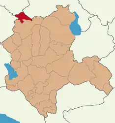 Map showing Çeltik District in Konya Province | |
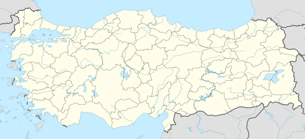 Çeltik Location in Turkey 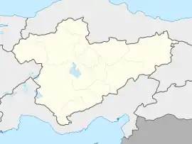 Çeltik Çeltik (Turkey Central Anatolia) | |
| Coordinates: 39°01′28″N 31°47′26″E / 39.02444°N 31.79056°E | |
| Country | Turkey |
| Province | Konya |
| Government | |
| • Mayor | Ali Meşe (AKP) |
| Area | 640 km2 (250 sq mi) |
| Elevation | 868 m (2,848 ft) |
| Population (2022)[1] | 9,429 |
| • Density | 15/km2 (38/sq mi) |
| Time zone | TRT (UTC+3) |
| Area code | 0332 |
| Climate | Csb |
| Website | www |
Çeltik (Turkish: çeltik, "paddy, rice in a husk") is a municipality and district of Konya Province, Turkey.[2] Its area is 640 km2,[3] and its population is 9,429 (2022).[1] Its elevation is 868 m (2,848 ft).[4]
Composition
There are 14 neighbourhoods in Çeltik District:[5]
- Adakasım
- Bahçelievler
- Bahçesaray
- Doğanyurt
- Fatih
- Gökpınar
- Honamlı
- İshakuşağı
- Karşıyaka
- Kaşören
- Küçükhasan
- Selçuk
- Torunlar
- Yukarı Aliçomak
References
- 1 2 "Address-based population registration system (ADNKS) results dated 31 December 2022, Favorite Reports" (XLS). TÜİK. Retrieved 19 September 2023.
- ↑ Büyükşehir İlçe Belediyesi, Turkey Civil Administration Departments Inventory. Retrieved 19 September 2023.
- ↑ "İl ve İlçe Yüz ölçümleri". General Directorate of Mapping. Retrieved 19 September 2023.
- ↑ Falling Rain Genomics, Inc. "Geographical information on Çeltik, Turkey". Retrieved 25 September 2023.
- ↑ Mahalle, Turkey Civil Administration Departments Inventory. Retrieved 19 September 2023.
External links
- District governor's official website (in Turkish)
- District municipality's official website (in Turkish)
Çeltik in Konya Province of Turkey | |||||||||||||||||||||||||||
|---|---|---|---|---|---|---|---|---|---|---|---|---|---|---|---|---|---|---|---|---|---|---|---|---|---|---|---|
| Districts | 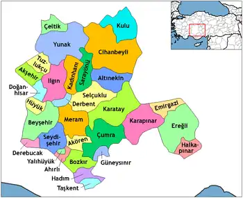 Districts of Konya | ||||||||||||||||||||||||||
| |||||||||||||||||||||||||||
Metropolitan municipalities are bolded. | |||||||||||||||||||||||||||
This article is issued from Wikipedia. The text is licensed under Creative Commons - Attribution - Sharealike. Additional terms may apply for the media files.