West Poplar
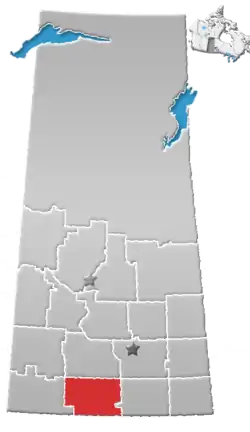
Location of West Poplar in Saskatchewan
West Poplar is the name given to the Canadian side of a border crossing on the Saskatchewan and Montana border. It is located about three and a half hours southwest of Regina, Saskatchewan. The international border crosses into Valley County, Montana, north of the town of Opheim.
Climate
| Climate data for West Poplar | |||||||||||||
|---|---|---|---|---|---|---|---|---|---|---|---|---|---|
| Month | Jan | Feb | Mar | Apr | May | Jun | Jul | Aug | Sep | Oct | Nov | Dec | Year |
| Record high °C (°F) | 13 (55) |
16 (61) |
22.5 (72.5) |
31 (88) |
37 (99) |
41 (106) |
38.3 (100.9) |
40 (104) |
37 (99) |
29 (84) |
24 (75) |
12 (54) |
41 (106) |
| Mean daily maximum °C (°F) | −7.7 (18.1) |
−4.3 (24.3) |
2.6 (36.7) |
11.6 (52.9) |
18.2 (64.8) |
23 (73) |
26.1 (79.0) |
26.1 (79.0) |
19.4 (66.9) |
12 (54) |
1.3 (34.3) |
−5.5 (22.1) |
10.2 (50.4) |
| Daily mean °C (°F) | −13.4 (7.9) |
−9.7 (14.5) |
−3.2 (26.2) |
4.6 (40.3) |
10.8 (51.4) |
15.6 (60.1) |
18.2 (64.8) |
17.7 (63.9) |
11.5 (52.7) |
5.1 (41.2) |
−4.5 (23.9) |
−11.1 (12.0) |
3.5 (38.3) |
| Mean daily minimum °C (°F) | −19.1 (−2.4) |
−15.1 (4.8) |
−8.9 (16.0) |
−2.5 (27.5) |
3.4 (38.1) |
8.2 (46.8) |
10.2 (50.4) |
9.3 (48.7) |
3.5 (38.3) |
−1.8 (28.8) |
−10.2 (13.6) |
−16.8 (1.8) |
−3.3 (26.1) |
| Record low °C (°F) | −45.6 (−50.1) |
−45 (−49) |
−44 (−47) |
−28.9 (−20.0) |
−11.1 (12.0) |
−5.5 (22.1) |
0 (32) |
−4 (25) |
−16 (3) |
−28 (−18) |
−35.5 (−31.9) |
−43.3 (−45.9) |
−45.6 (−50.1) |
| Average precipitation mm (inches) | 19 (0.7) |
13.6 (0.54) |
21.2 (0.83) |
22.1 (0.87) |
59.1 (2.33) |
69.7 (2.74) |
60.5 (2.38) |
36.6 (1.44) |
33.2 (1.31) |
21.3 (0.84) |
15.3 (0.60) |
22.3 (0.88) |
393.7 (15.50) |
| Source: Environment Canada[1] | |||||||||||||
See also
References
- ↑ Environment Canada - Canadian Climate Normals 1971-2000—Canadian Climate Normals 1971–2000, accessed 27 December 2010
49°00′00″N 106°22′02″W / 49.00000°N 106.36722°W
This article is issued from Wikipedia. The text is licensed under Creative Commons - Attribution - Sharealike. Additional terms may apply for the media files.