Weiler-la-Tour
| |
|---|---|
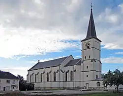 Weiler-la-Tour church | |
 Coat of arms | |
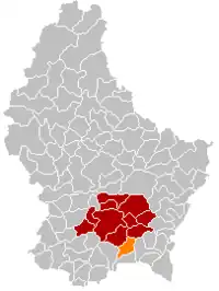 Map of Luxembourg with Weiler-la-Tour highlighted in orange, and the canton in dark red | |
| Coordinates: 49°32′33″N 6°11′59″E / 49.5425°N 6.1997°E | |
| Country | |
| Canton | Luxembourg |
| Government | |
| • Mayor | Vincent Reding (CSV) |
| Area | |
| • Total | 17.07 km2 (6.59 sq mi) |
| • Rank | 69th of 102 |
| Highest elevation | 329 m (1,079 ft) |
| • Rank | 92nd of 102 |
| Lowest elevation | 243 m (797 ft) |
| • Rank | 53rd of 102 |
| Population (2023) | |
| • Total | 2,498 |
| • Rank | 62nd of 102 |
| • Density | 150/km2 (380/sq mi) |
| • Rank | 51st of 102 |
| Time zone | UTC+1 (CET) |
| • Summer (DST) | UTC+2 (CEST) |
| LAU 2 | LU0000311 |
| Website | weiler-la-tour.lu |
Weiler-la-Tour (Luxembourgish: Weiler zum Tuer, German: Weiler zum Turm) is a commune and small town in southern Luxembourg. It is located south-east of Luxembourg City. The commune's administrative centre is Hassel.
As of 2005, the town of Weiler-la-Tour, which lies in the south of the commune, has a population of 477. Other towns within the commune include Hassel and Syren.
Population
References
- ↑ "WEILER-LA-TOUR - Syvicol". www.syvicol.lu. Retrieved 3 April 2019.
- ↑ "Population par canton et commune". statistiques.public.lu. Retrieved 11 January 2022.
External links
 Media related to Weiler-la-Tour at Wikimedia Commons
 | ||
This article is issued from Wikipedia. The text is licensed under Creative Commons - Attribution - Sharealike. Additional terms may apply for the media files.