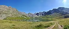
Val-d'Oronaye
| |
|---|---|
 | |
Location of Val-d'Oronaye | |
 Val-d'Oronaye 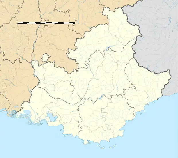 Val-d'Oronaye | |
| Coordinates: 44°28′34″N 6°47′56″E / 44.476°N 6.799°E | |
| Country | France |
| Region | Provence-Alpes-Côte d'Azur |
| Department | Alpes-de-Haute-Provence |
| Arrondissement | Barcelonnette |
| Canton | Barcelonnette |
| Intercommunality | CC Vallée de l'Ubaye - Serre-Ponçon |
| Government | |
| • Mayor (2022–2026) | Chantal Donneaud[1] |
| Area 1 | 109.45 km2 (42.26 sq mi) |
| Population | 108 |
| • Density | 0.99/km2 (2.6/sq mi) |
| Time zone | UTC+01:00 (CET) |
| • Summer (DST) | UTC+02:00 (CEST) |
| INSEE/Postal code | 04120 /04530 |
| 1 French Land Register data, which excludes lakes, ponds, glaciers > 1 km2 (0.386 sq mi or 247 acres) and river estuaries. | |
Val-d'Oronaye (French pronunciation: [val dɔʁɔnaj]; Occitan: Vau d'Oronaia) is an alpine commune on the Italian border in the Alpes-de-Haute-Provence department in the southeastern Provence-Alpes-Côte d'Azur region in France. It was established on 1 January 2016, consisting of the former communes of Meyronnes and Larche.[3] In 2020, it had a population of 117.
References
- ↑ "Répertoire national des élus: les maires" (in French). data.gouv.fr, Plateforme ouverte des données publiques françaises. 13 September 2022.
- ↑ "Populations légales 2021". The National Institute of Statistics and Economic Studies. 28 December 2023.
- ↑ Arrêté préfectoral 14 December 2015 (in French)
See also
This article is issued from Wikipedia. The text is licensed under Creative Commons - Attribution - Sharealike. Additional terms may apply for the media files.