| Upper Red Lake | |
|---|---|
 Upper Red Lake | |
| Location | Beltrami County, Minnesota |
| Coordinates | 48°16′16″N 95°00′42″W / 48.27111°N 95.01167°W |
| Primary outflows | Lower Red Lake |
| Surface area | Upper Red Lake is 120,000 acres (49,000 ha): 60% (72,000 acres) of which is under the jurisdiction of the Red Lake Band of Chippewa Indians (Red Lake Band), 40% (48,000 acres) falls under the jurisdiction of the State of Minnesota. |
| Max. depth | 15 ft (4.6 m) |
Upper Red Lake is an unorganized territory in Beltrami County, Minnesota, U.S. It is a part of the Red Lake Indian Reservation. The population was 26 at the 2020 census.
Geography
According to the United States Census Bureau, the unorganized territory has a total area of 841.9 square miles (2,180.4 km2), of which 694.2 square miles (1,798.1 km2) is land and 147.6 square miles (382.3 km2) (17.53%) is water.
References
Municipalities and communities of Beltrami County, Minnesota, United States | ||
|---|---|---|
| Cities | 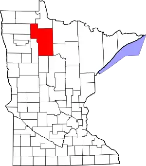 Map of Minnesota highlighting Beltrami County | |
| Townships |
| |
| CDPs | ||
| Unorganized territories | ||
| Unincorporated communities | ||
| Indian reservations | ||
| Footnotes | ‡This populated place also has portions in an adjacent county or counties | |
This article is issued from Wikipedia. The text is licensed under Creative Commons - Attribution - Sharealike. Additional terms may apply for the media files.