Unterbrunn | |
|---|---|
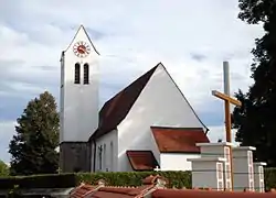 Church of Saint Lawrence | |
Location of Unterbrunn | |
 Unterbrunn 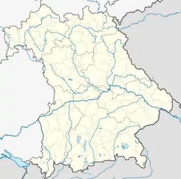 Unterbrunn | |
| Coordinates: 48°03′59.28″N 11°19′25.69″E / 48.0664667°N 11.3238028°E | |
| Country | Germany |
| State | Bavaria |
| District | Starnberg |
| Town | Gauting |
| Time zone | UTC+01:00 (CET) |
| • Summer (DST) | UTC+02:00 (CEST) |
| Website | www |
The village of Unterbrunn is an Ortsteil (quarter) of the municipality Gauting, in Bavaria, Germany. It lies close to and east of the Oberpfaffenhofen Airfield (with IATA code: OBF).
Unterbrunn has a Roman Catholic parish church with organ pipes housed above the ceiling. It also boasts a private museum, basically eclectic but with many historic farm implements.
History
Maria Himmelfahrt Catholic church located in the center of Unterbrunn was built between 1872 and 1875 as a sandstone block building in Romanized forms.[1]
References
- ↑
Naxxos (June 16, 2021). "Unterbrunn Bike Touring Highlight". komoot. Retrieved 2022-07-23.
Unterbrunn
External links
This article is issued from Wikipedia. The text is licensed under Creative Commons - Attribution - Sharealike. Additional terms may apply for the media files.