Turaif
طريف | |
|---|---|
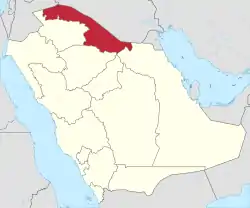 Turaif Location in Northern Borders Province, Saudi Arabia | |
| Coordinates: 31°40′39″N 038°39′11″E / 31.67750°N 38.65306°E | |
| Country | |
| Province | Northern Borders |
| Population (2015)[1] | |
| • Total | 91,713 |
Turaif (Arabic: طريف) is a town in Northern Borders Province (also known as Al-Hudud ash Shamaliyah), Saudi Arabia, close to the border with Jordan. Turaif is located at a bend in Highway 85 as it turns west to Jordan. It is located at around 31°40′39″N 38°39′11″E / 31.67750°N 38.65306°E. As of 2010, it has a population of 48,929.[1] The city of Turaif is one of the cities that have been established because of the presence of the Trans-Arabian Pipeline.
Highway 85 bisects Turaif into "Old" Turaif to the north and "New" Turaif to the south. The largest hotel in Turaif is the Al-Mudwah Hotel and SWISS SPIRIT located along Highway 85 as it cuts through the town.
Turaif Domestic Airport is located approximately 5 kilometres (3 mi) from town and has a daily flight to Riyadh. Other nearby airports are Gurayat Domestic Airport in Gurayat (Qurayyat) and Arar Domestic Airport in Arar.
Climate
Turaif has hot desert climate (Köppen climate classification: BWh) with long, very hot summers and cool winters. Frost during the night is common in the winter months. Snow may also fall at times .
| Climate data for Turaif, Saudi Arabia | |||||||||||||
|---|---|---|---|---|---|---|---|---|---|---|---|---|---|
| Month | Jan | Feb | Mar | Apr | May | Jun | Jul | Aug | Sep | Oct | Nov | Dec | Year |
| Record high °C (°F) | 24.7 (76.5) |
28.6 (83.5) |
32.2 (90.0) |
36.6 (97.9) |
41.9 (107.4) |
44.5 (112.1) |
46.8 (116.2) |
46.6 (115.9) |
43.4 (110.1) |
38.8 (101.8) |
33.0 (91.4) |
26.8 (80.2) |
46.8 (116.2) |
| Mean daily maximum °C (°F) | 11.9 (53.4) |
14.8 (58.6) |
18.5 (65.3) |
23.8 (74.8) |
28.9 (84.0) |
34.4 (93.9) |
39.2 (102.6) |
37.9 (100.2) |
32.8 (91.0) |
26.7 (80.1) |
18.8 (65.8) |
13.2 (55.8) |
25.1 (77.1) |
| Daily mean °C (°F) | 5.5 (41.9) |
8.7 (47.7) |
12.4 (54.3) |
17.6 (63.7) |
22.8 (73.0) |
27.8 (82.0) |
30.7 (87.3) |
29.9 (85.8) |
25.4 (77.7) |
19.7 (67.5) |
12.9 (55.2) |
7.8 (46.0) |
18.4 (65.2) |
| Mean daily minimum °C (°F) | −1.0 (30.2) |
2.7 (36.9) |
6.2 (43.2) |
11.5 (52.7) |
16.6 (61.9) |
21.2 (70.2) |
22.5 (72.5) |
21.8 (71.2) |
17.9 (64.2) |
12.6 (54.7) |
7.0 (44.6) |
2.4 (36.3) |
11.8 (53.2) |
| Record low °C (°F) | −12.2 (10.0) |
−9.9 (14.2) |
−5.7 (21.7) |
−1.9 (28.6) |
6.1 (43.0) |
11.0 (51.8) |
14.4 (57.9) |
13.6 (56.5) |
5.5 (41.9) |
−2.6 (27.3) |
−8.0 (17.6) |
−11.9 (10.6) |
−12.2 (10.0) |
| Average precipitation mm (inches) | 7.8 (0.31) |
9.1 (0.36) |
5.4 (0.21) |
10.6 (0.42) |
5.5 (0.22) |
0 (0) |
0 (0) |
0 (0) |
0.4 (0.02) |
0.9 (0.04) |
12.6 (0.50) |
14.3 (0.56) |
66.6 (2.64) |
| Source: Weather Reports | |||||||||||||
References
- 1 2 "Saudi Arabia". Geohive.