| Thoré | |
|---|---|
 | |
.png.webp) | |
| Location | |
| Country | France |
| Physical characteristics | |
| Source | |
| • location | Rieussec |
| • coordinates | 43°26′21″N 02°43′14″E / 43.43917°N 2.72056°E |
| • elevation | 800 m (2,600 ft) |
| Mouth | |
• location | Agout |
• coordinates | 43°34′52″N 02°13′04″E / 43.58111°N 2.21778°E |
• elevation | 163 m (535 ft) |
| Length | 61.6 km (38.3 mi) |
| Basin size | 608 km2 (235 sq mi) |
| Discharge | |
| • average | 15.9 m3/s (560 cu ft/s) |
| Basin features | |
| Progression | Agout→ Tarn→ Garonne→ Gironde estuary→ Atlantic Ocean |
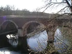
The Thoré (French pronunciation: [tɔʁe]) is a 61.6-kilometre-long (38.3 mi) river in the Hérault and Tarn departments in southern France.[1] Its source is in the northern part of Rieussec. It flows generally northwest. It is a left tributary of the Agout, into which it flows between Navès and Castres.
Departments and communes along its course
This list is ordered from source to mouth:
References
This article is issued from Wikipedia. The text is licensed under Creative Commons - Attribution - Sharealike. Additional terms may apply for the media files.