Theresienfeld | |
|---|---|
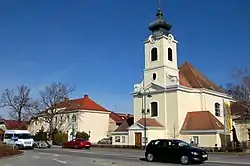 Municipal office and the Holy Cross Church | |
 Coat of arms | |
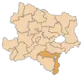
 Theresienfeld Location within Austria | |
| Coordinates: 47°51′N 16°15′E / 47.850°N 16.250°E | |
| Country | Austria |
| State | Lower Austria |
| District | Wiener Neustadt-Land |
| Government | |
| • Mayor | Ingrid Klauninger (SPÖ) |
| Area | |
| • Total | 11.44 km2 (4.42 sq mi) |
| Elevation | 282 m (925 ft) |
| Population (2018-01-01)[2] | |
| • Total | 3,485 |
| • Density | 300/km2 (790/sq mi) |
| Time zone | UTC+1 (CET) |
| • Summer (DST) | UTC+2 (CEST) |
| Postal code | 2604 |
| Area code | 02622 |
| Vehicle registration | WB |
| Website | www.theresienfeld.gv.at |
Theresienfeld is a town in the Wiener Neustadt-Land district of Lower Austria, in eastern Austria. It lies 5 km (3 miles) north of Wiener Neustadt, in the southern part of the Vienna Basin. Of its 11.47 km2 area, 3.40% is forested.[3]
Population
| Year | Pop. | ±% |
|---|---|---|
| 1971 | 1,115 | — |
| 1981 | 1,518 | +36.1% |
| 1991 | 1,963 | +29.3% |
| 2001 | 2,490 | +26.8% |
| 2005 | 2,703 | +8.6% |
| 2011 | 2,884 | +6.7% |
History
Theresienfeld was founded in 1763 by Empress Maria Theresa, for the agricultural development of the area.
Economy and education
In 2011, there were 169 non-agricultural jobs in the municipality, and 14 agriculturally and forestry related companies. 109 persons were unemployed.[3]
Theresienfeld has two kindergartens, a primary school, and a vocational school.[4]
References
- ↑ "Dauersiedlungsraum der Gemeinden Politischen Bezirke und Bundesländer - Gebietsstand 1.1.2018". Statistics Austria. Retrieved 10 March 2019.
- ↑ "Einwohnerzahl 1.1.2018 nach Gemeinden mit Status, Gebietsstand 1.1.2018". Statistics Austria. Retrieved 9 March 2019.
- 1 2 Statistical data
- ↑ Schools in Theresienfeld
External links
This article is issued from Wikipedia. The text is licensed under Creative Commons - Attribution - Sharealike. Additional terms may apply for the media files.