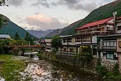
Tenkawa
天川村 | |
|---|---|
Village | |
 | |
 Flag  Emblem | |
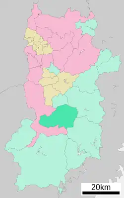 Location of Tenkawa in Nara Prefecture | |
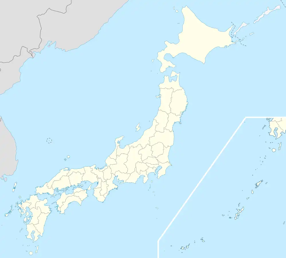 Tenkawa Location in Japan | |
| Coordinates: 34°15′N 135°51′E / 34.250°N 135.850°E | |
| Country | Japan |
| Region | Kansai |
| Prefecture | Nara Prefecture |
| District | Yoshino |
| Government | |
| • Mayor | Yasumaro Kakisaka |
| Area | |
| • Total | 175.70 km2 (67.84 sq mi) |
| Population (October 1, 2016) | |
| • Total | 1,310 |
| • Density | 7.5/km2 (19/sq mi) |
| Time zone | UTC+09:00 (JST) |
| City hall address | 60 Ōaza Sawatani, Tenkawa-mura, Yoshino-gun, Nara-ken 638-0305 |
| Website | www |
| Symbols | |
| Bird | Komadori (Japanese robin) |
| Flower | Ooyama renge (Magnolia sieboldii) |
| Tree | Sugi (Cryptomeria) |
Tenkawa (天川村, Tenkawa-mura) is a village located in Yoshino District, Nara Prefecture, Japan.
As of October 2016, the village has an estimated population of 1,310 and a density of 7.5 persons per km2. The total area is 175.70 km2.
Education
- Kindergartens
- Tenkawa Preschool Kindergarten
- Primary Schools
- Tenkawa Elementary School
- Junior High Schools
- Tenkawa Junior High School
Notable places
- Yoshino-Kumano National Park
- Dorogawa Hot Springs
- Ten-no-kawa Hot Springs
- Mount Ōmine Temple
- Mount Ōmine Ryusenji Temple
- Mitarai Valley
See also
External links
 Media related to Tenkawa, Nara at Wikimedia Commons
- Tenkawa official website (in Japanese)
| Core city | ||
|---|---|---|
| Cities | ||
| Districts | ||
This article is issued from Wikipedia. The text is licensed under Creative Commons - Attribution - Sharealike. Additional terms may apply for the media files.