Tabou | |
|---|---|
Town, sub-prefecture, and commune | |
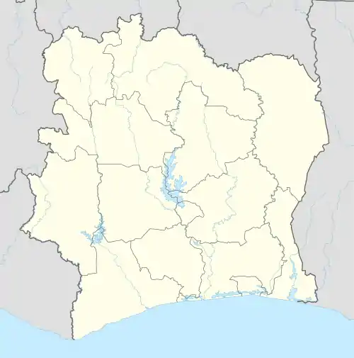 Tabou Location in Ivory Coast | |
| Coordinates: 4°25′N 7°21′W / 4.417°N 7.350°W | |
| Country | |
| District | Bas-Sassandra |
| Region | San-Pédro |
| Department | Tabou |
| Area | |
| • Total | 429 km2 (166 sq mi) |
| Population (2021 census)[1] | |
| • Total | 62,719 |
| • Density | 150/km2 (380/sq mi) |
| • Town | 22,733[2] |
| (2014 census) | |
| Time zone | UTC+0 (GMT) |
Tabou is a town in the far southwest of Ivory Coast, near the border of Liberia. It is a sub-prefecture of and the seat of Tabou Department in San-Pédro Region, Bas-Sassandra District. Tabou is also a commune.
In 2021, the population of the sub-prefecture of Tabou was 62,719.[1]
Villages
The 32 villages of the sub-prefecture of Tabou and their population in 2014 are:[3]
- Bianké (304)
- Blédiéké (152)
- Boké (2 043)
- Dégné (191)
- Douke (97)
- Douopo (381)
- Gbaouloké (325)
- Gléroké (232)
- Gliké V1 (1 201)
- Gliké V3 (688)
- Hiépodioké (370)
- Ombloké (295)
- Sékréké (495)
- Souké (203)
- Tabou (22 733)
- Tolou (209)
- Yonaké (245)
- Besséréké (471)
- Boubélé (1 355)
- Déhié (1 537)
- Gliké V2 (719)
- Gliké Village (129)
- Gnadjipo (96)
- Gotouké (763)
- Guirou (352)
- Irodioké (223)
- Kabiadioké (182)
- Klatoué (312)
- Ménéké (1 481)
- Ouédjiré (837)
- Oulidié (46)
- Toulaké (323)
Climate
Tabou has a tropical monsoon climate under the Köppen climate classification, with a long wet season.
| Climate data for Tabou, Ivory Coast | |||||||||||||
|---|---|---|---|---|---|---|---|---|---|---|---|---|---|
| Month | Jan | Feb | Mar | Apr | May | Jun | Jul | Aug | Sep | Oct | Nov | Dec | Year |
| Mean daily maximum °C (°F) | 29.9 (85.8) |
30.6 (87.1) |
30.9 (87.6) |
31.3 (88.3) |
29.5 (85.1) |
27.8 (82.0) |
27.0 (80.6) |
26.4 (79.5) |
27.1 (80.8) |
28.2 (82.8) |
29.0 (84.2) |
29.3 (84.7) |
28.9 (84.0) |
| Daily mean °C (°F) | 25.6 (78.1) |
26.5 (79.7) |
26.7 (80.1) |
26.7 (80.1) |
26.3 (79.3) |
25.3 (77.5) |
24.6 (76.3) |
24.2 (75.6) |
24.6 (76.3) |
25.3 (77.5) |
25.8 (78.4) |
25.6 (78.1) |
25.6 (78.1) |
| Mean daily minimum °C (°F) | 21.5 (70.7) |
22.2 (72.0) |
22.4 (72.3) |
22.5 (72.5) |
22.8 (73.0) |
22.6 (72.7) |
22.0 (71.6) |
21.9 (71.4) |
22.1 (71.8) |
22.4 (72.3) |
22.4 (72.3) |
21.9 (71.4) |
22.2 (72.0) |
| Average rainfall mm (inches) | 45.6 (1.80) |
43.1 (1.70) |
75.7 (2.98) |
134.1 (5.28) |
367.4 (14.46) |
544.3 (21.43) |
222.0 (8.74) |
154.3 (6.07) |
233.9 (9.21) |
169.3 (6.67) |
178.0 (7.01) |
130.8 (5.15) |
2,298.5 (90.5) |
| Mean monthly sunshine hours | 197.7 | 191.5 | 195.8 | 201.3 | 157.9 | 90.3 | 94.4 | 83.8 | 84.1 | 185.6 | 210.9 | 188.6 | 1,881.9 |
| Source: NOAA[4] | |||||||||||||
References
- 1 2 Citypopulation.de Population of the regions and sub-prefektures of Ivory Coast
- ↑ Citypopulation.de Population of cities & localities in Ivory Coast
- ↑ Citypopulation.de Population of the localities in the sub-prefekture of Tabou
- ↑ "Tabou Climate Normals 1961–1990". National Oceanic and Atmospheric Administration. Retrieved 21 December 2015.
Regional seat: San-Pédro | ||
| San-Pédro Department | 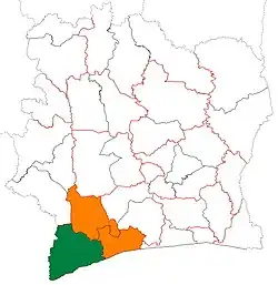 | |
| Tabou Department | ||
* also a commune | ||
This article is issued from Wikipedia. The text is licensed under Creative Commons - Attribution - Sharealike. Additional terms may apply for the media files.